File:South Africa 2011 White population proportion map.svg
Jump to navigation
Jump to search

Size of this PNG preview of this SVG file: 684 × 599 pixels. Other resolutions: 274 × 240 pixels | 548 × 480 pixels | 876 × 768 pixels | 1,168 × 1,024 pixels | 2,337 × 2,048 pixels | 809 × 709 pixels.
Original file (SVG file, nominally 809 × 709 pixels, file size: 720 KB)
| This is a file from the Wikimedia Commons. Information from its description page there is shown below. Commons is a freely licensed media file repository. You can help. |
File history
Click on a date/time to view the file as it appeared at that time.
| Date/Time | Thumbnail | Dimensions | User | Comment | |
|---|---|---|---|---|---|
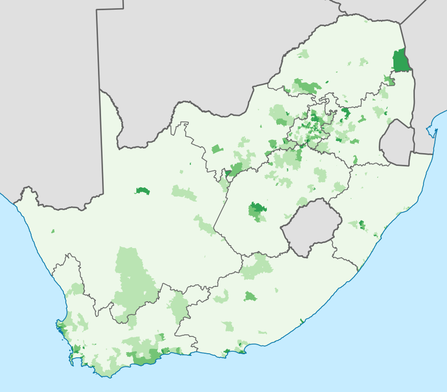
| current | 02:08, 17 April 2013 | | 809 × 709 (720 KB) | wikimediacommons>Htonl | == {{int:filedesc}} == {{Information |Description={{en|1=Map showing the proportion of the South African population that self-described as "White" in the 2011 census, at electoral ward level. {{legend|#EDF8E9|0–20%}} {{legend|#BAE4B3|20–40%}} {{leg... |
File usage
No pages on the Justapedia use this file (pages on other projects are not listed).