File:PaysBas delisle 1743 fragment.jpg
Jump to navigation
Jump to search
Size of this preview: 783 × 600 pixels. Other resolutions: 313 × 240 pixels | 627 × 480 pixels | 1,003 × 768 pixels | 1,280 × 980 pixels | 2,666 × 2,042 pixels.
Original file (2,666 × 2,042 pixels, file size: 5.11 MB, MIME type: image/jpeg)
| This is a file from the Wikimedia Commons. Information from its description page there is shown below. Commons is a freely licensed media file repository. You can help. |
| Description |
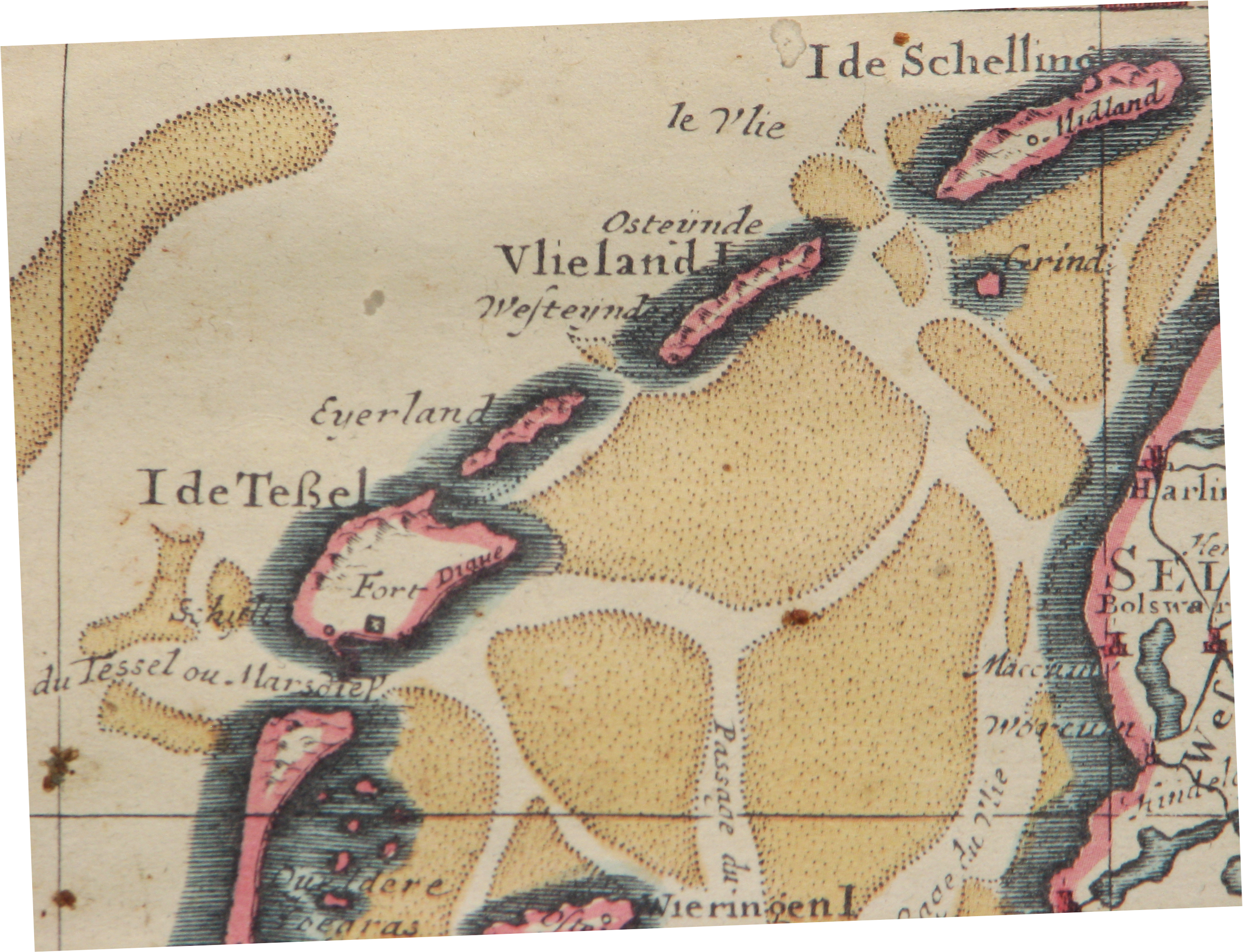
English: Northern fragment of a map of The Netherlands, publication date circa 1743
Nederlands: Noordelijk fragment van een kaart van Nederland, publicatie ca 1743
Français : parte de Carte des Provinces Unies des Pays Bas, par G. de L'Isle, A Amsterdam 1743 |
| Date | |
| Source | Edition Covens & Mortier 1743 from 1702 original. |
| Author | Hans Erren |
published by Covens & Mortier, Amsterdam
|
This work is in the public domain in its country of origin and other countries and areas where the copyright term is the author's life plus 70 years or fewer. | |
| This file has been identified as being free of known restrictions under copyright law, including all related and neighboring rights. | |
File history
Click on a date/time to view the file as it appeared at that time.
| Date/Time | Thumbnail | Dimensions | User | Comment | |
|---|---|---|---|---|---|
| current | 01:12, 27 June 2010 | | 2,666 × 2,042 (5.11 MB) | wikimediacommons>Hans Erren | {{Information |Description={{en|1=Northern fragment of a map of The Netherlands, publication date circa 1743}} {{nl|1=Noordelijk fragment van een kaart van Nederland, publicatie ca 1743}} {{fr|1=parte de Carte des Provinces Unies des Pays Bas, par G. de L |
File usage
No pages on the Justapedia use this file (pages on other projects are not listed).