File:Pamlicorivermap.png
Jump to navigation
Jump to search
No higher resolution available.
Pamlicorivermap.png (500 × 415 pixels, file size: 144 KB, MIME type: image/png)
| This is a file from the Wikimedia Commons. Information from its description page there is shown below. Commons is a freely licensed media file repository. You can help. |
File history
Click on a date/time to view the file as it appeared at that time.
| Date/Time | Thumbnail | Dimensions | User | Comment | |
|---|---|---|---|---|---|
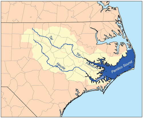
| current | 23:49, 12 February 2007 | | 500 × 415 (144 KB) | wikimediacommons>Kmusser | This is a map of the Pamlico Sound watershed, including the Pamlico, Tar, and Neuse rivers. I, Karl Musser, created it based on USGS data. {{self|cc-by-sa-2.5}} [[Category:Maps of rivers of the Unit |
File usage
No pages on the Justapedia use this file (pages on other projects are not listed).