File:Oregon Route 451.svg
Jump to navigation
Jump to search

Size of this PNG preview of this SVG file: 800 × 444 pixels. Other resolutions: 320 × 178 pixels | 640 × 356 pixels | 1,024 × 569 pixels | 1,280 × 711 pixels | 2,560 × 1,422 pixels | 1,152 × 640 pixels.
Original file (SVG file, nominally 1,152 × 640 pixels, file size: 21 KB)
| This is a file from the Wikimedia Commons. Information from its description page there is shown below. Commons is a freely licensed media file repository. You can help. |
File history
Click on a date/time to view the file as it appeared at that time.
| Date/Time | Thumbnail | Dimensions | User | Comment | |
|---|---|---|---|---|---|
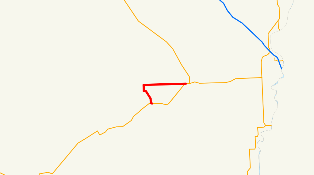
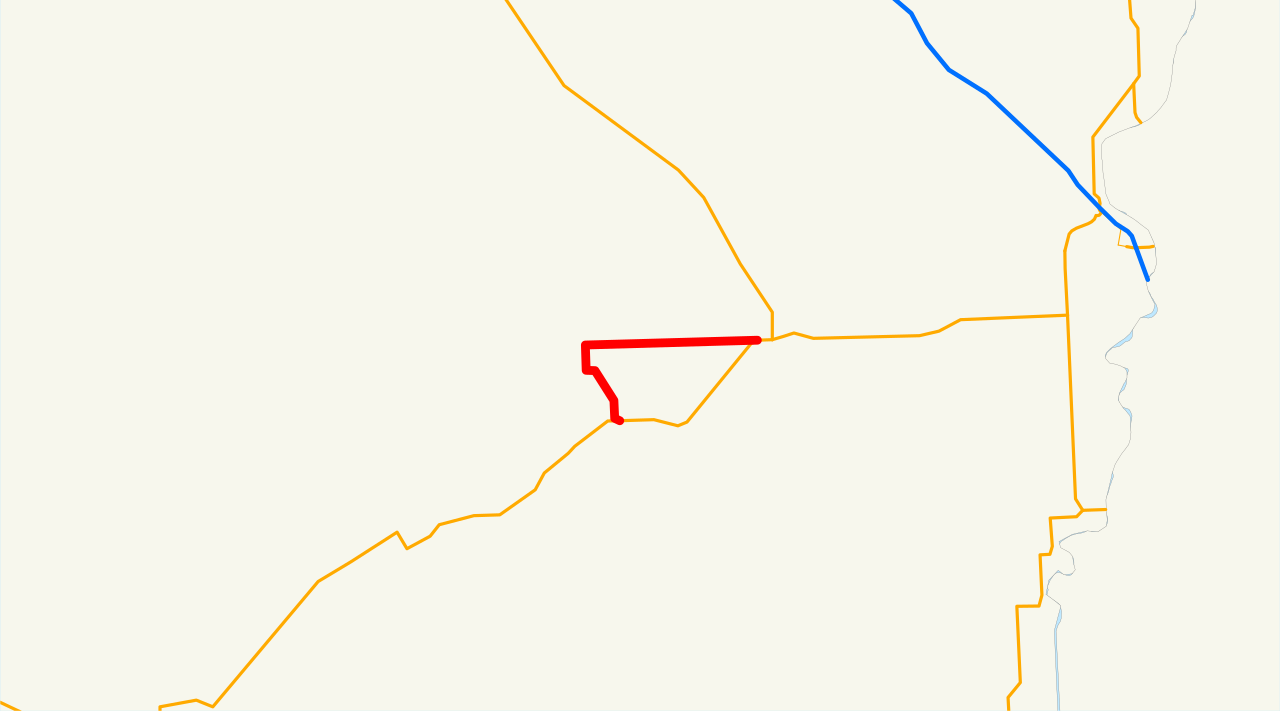
| current | 20:18, 12 April 2008 | | 1,152 × 640 (21 KB) | wikimediacommons>NE2 | == Summary == This is a map of Oregon Route 451 (Vale-West Highway No. 451). Email me if you would like a copy of the GIS data I created for the highways. Category:Oregon Route 451 [[Category:Maps of highway routes in Oregon |
File usage
No pages on the Justapedia use this file (pages on other projects are not listed).