File:Nyungwe rahvuspark Landsat 19jul86.jpg
Jump to navigation
Jump to search

Size of this preview: 600 × 600 pixels. Other resolutions: 240 × 240 pixels | 480 × 480 pixels | 768 × 768 pixels | 1,024 × 1,024 pixels | 2,048 × 2,048 pixels | 3,000 × 3,000 pixels.
Original file (3,000 × 3,000 pixels, file size: 2.75 MB, MIME type: image/jpeg)
| This is a file from the Wikimedia Commons. Information from its description page there is shown below. Commons is a freely licensed media file repository. You can help. |
Summary
| Description |
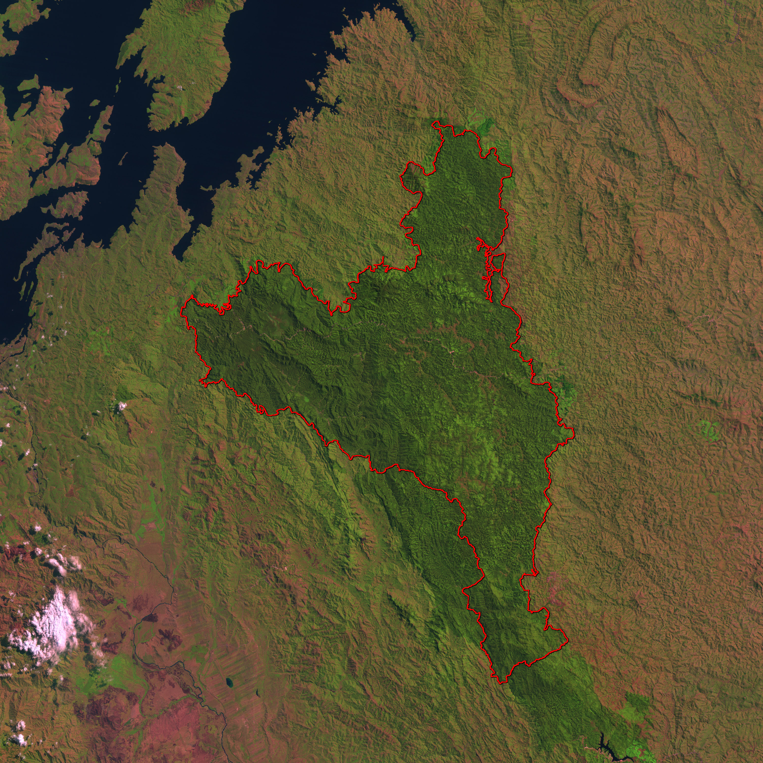
Afrikaans: 'n Satellietbeeld van Nyungwe- Nasionale Park in die suidweste van Rwanda, geneem op 19 Julie 1986, met die Kivu-meeroewer bo links sigbaar. Die Mukura-bosreservaat is buite beeld, na die noorde.
Eesti: Satelliidipilt Nyungwe rahvuspargist, 1986 |
| Date | |
| Source | Earth Observatory |
| Author | Earth Observatory |
| Object location | | View this and other nearby images on: OpenStreetMap |
|---|
Licensing
| This file is in the public domain in the United States because it was solely created by NASA. NASA copyright policy states that "NASA material is not protected by copyright unless noted". (See Template:PD-USGov, NASA copyright policy page or JPL Image Use Policy.) | ||
 |
Warnings:
|
Original upload log
The original description page was here. All following user names refer to et.wikipedia.
- 2011-01-10 21:37 Epp 3000×3000× (2883368 bytes) Pilt on pärit [http://earthobservatory.nasa.gov/IOTD/view.php?id=4314 siit]. {{AO-US-Keskv}}
File history
Click on a date/time to view the file as it appeared at that time.
| Date/Time | Thumbnail | Dimensions | User | Comment | |
|---|---|---|---|---|---|
| current | 15:26, 26 April 2012 | | 3,000 × 3,000 (2.75 MB) | wikimediacommons>File Upload Bot (Magnus Manske) | Transferred from http://eoimages.gsfc.nasa.gov/images/imagerecords/4000/4314/landsat_nyungwe_19jul86_30m.jpg by [[User:]] using url2commons |
File usage
No pages on the Justapedia use this file (pages on other projects are not listed).