File:Norris WestAJ Map.jpg
Jump to navigation
Jump to search

Size of this preview: 532 × 599 pixels. Other resolutions: 213 × 240 pixels | 426 × 480 pixels | 945 × 1,064 pixels.
Original file (945 × 1,064 pixels, file size: 456 KB, MIME type: image/jpeg)
| This is a file from the Wikimedia Commons. Information from its description page there is shown below. Commons is a freely licensed media file repository. You can help. |
File history
Click on a date/time to view the file as it appeared at that time.
| Date/Time | Thumbnail | Dimensions | User | Comment | |
|---|---|---|---|---|---|
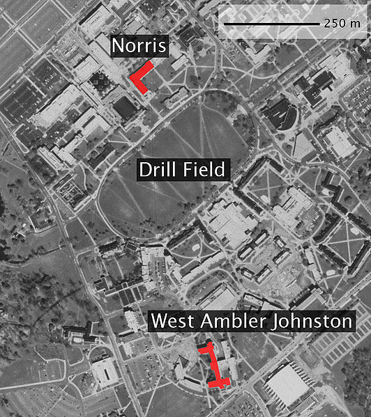
| current | 04:21, 18 April 2007 | | 945 × 1,064 (456 KB) | wikimediacommons>Dnowacki | {{Information |Description=Map of Virginia tech with Norris and West Ambler Johnston Hall highlighted. Basemap from TerraServer (USGS). |Source=self-made |Date=2007-04-17 |Author= en:User:Dnowacki |other_versions= }} |
File usage
No pages on the Justapedia use this file (pages on other projects are not listed).