File:Map of the Royal Burgh of Kirkcaldy 1824.jpg
Jump to navigation
Jump to search
Size of this preview: 469 × 600 pixels. Other resolutions: 188 × 240 pixels | 375 × 480 pixels | 601 × 768 pixels | 801 × 1,024 pixels | 1,602 × 2,048 pixels | 3,490 × 4,462 pixels.
Original file (3,490 × 4,462 pixels, file size: 3.59 MB, MIME type: image/jpeg)
| This is a file from the Wikimedia Commons. Information from its description page there is shown below. Commons is a freely licensed media file repository. You can help. |
Summary
| Description |
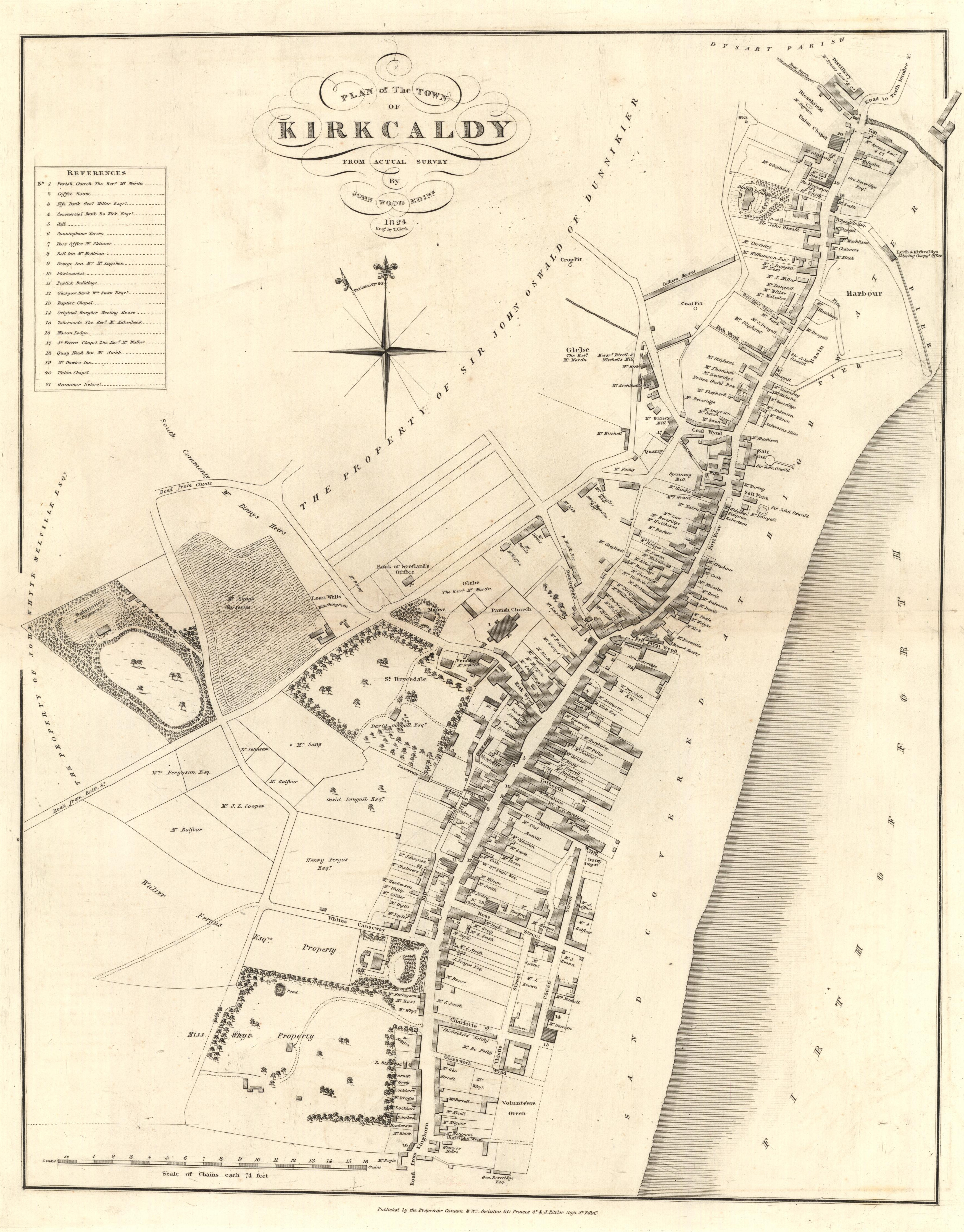
English: Royal Burgh of Kirkcaldy 1824 Map |
|||
| Date | ||||
| Source |
http://www.nls.uk/maps/early/towns.cfm?id=371 |
|||
| Author | Trustees of the National Library of Scotland |


Licensing
|
This work is in the public domain in its country of origin and other countries and areas where the copyright term is the author's life plus 100 years or fewer. | |
| This file has been identified as being free of known restrictions under copyright law, including all related and neighboring rights. | |
Original upload log
The original description page was here. All following user names refer to en.wikipedia.
- 2008-04-10 23:38 Kilnburn 250×314× (17718 bytes) {{attribution|user:Kilburn}} {{logo fur | Article = | Use = Map <!-- ADDITIONAL INFORMATION --> | Used for = Kirkcaldy Article (for a forthcoming revamp) | Owner = Trustees of the National Libra
File history
Click on a date/time to view the file as it appeared at that time.
| Date/Time | Thumbnail | Dimensions | User | Comment | |
|---|---|---|---|---|---|
| current | 02:27, 9 July 2013 | | 3,490 × 4,462 (3.59 MB) | wikimediacommons>Knochen | full sollution from source |
File usage
No pages on the Justapedia use this file (pages on other projects are not listed).