File:Map of Russia - Siberian Federal District.svg
Jump to navigation
Jump to search

Size of this PNG preview of this SVG file: 800 × 462 pixels. Other resolutions: 320 × 185 pixels | 640 × 369 pixels | 1,024 × 591 pixels | 1,280 × 738 pixels | 2,560 × 1,477 pixels | 1,092 × 630 pixels.
Original file (SVG file, nominally 1,092 × 630 pixels, file size: 118 KB)
| This is a file from the Wikimedia Commons. Information from its description page there is shown below. Commons is a freely licensed media file repository. You can help. |

|
The boundaries on this map show the de facto situation. This is just one of several different views on the subject (see COM:NPOV). |
| Description |
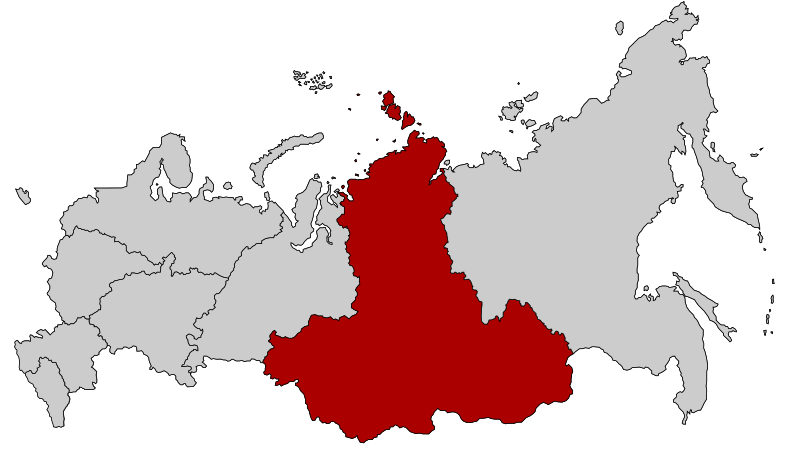
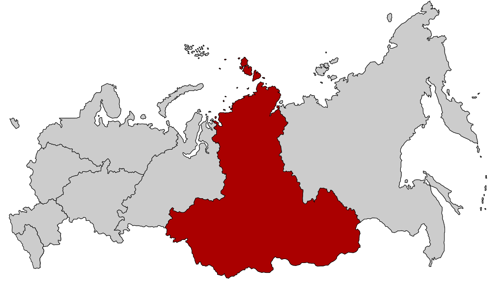
English: Map Russia highlighting the Siberian Federal districts.
Español: Ubicación del Distrito Federal de Siberia en la Federación Rusa
Русский: Сибирский федеральный округ |
| Date | |
| Source | Based on Map of Russian subjects, 2008-03-01.svg by Lokal_Profil |
| Author | Lokal_Profil |
| Permission (Reusing this file) |
This file is licensed under the Creative Commons Attribution-Share Alike 2.5 Generic license.
|
File history
Click on a date/time to view the file as it appeared at that time.
| Date/Time | Thumbnail | Dimensions | User | Comment | |
|---|---|---|---|---|---|
| current | 00:52, 27 February 2022 | | 1,092 × 630 (118 KB) | wikimediacommons>Valar999 | NPOV issue |
File usage
No pages on the Justapedia use this file (pages on other projects are not listed).