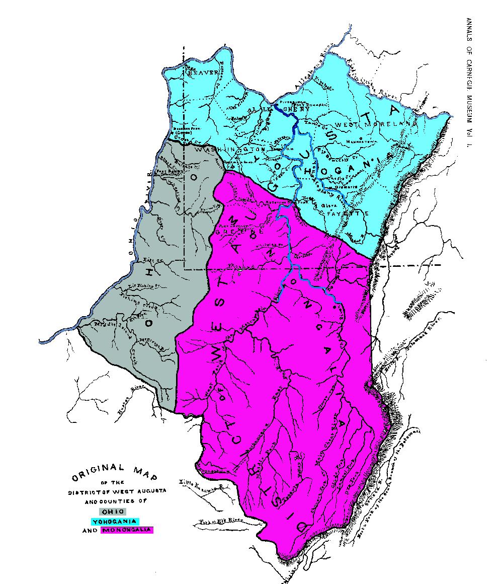
File:Map of Ohio, Monongalia, & Yohogania Counties.jpg
Jump to navigation
Jump to search
Size of this preview: 518 × 600 pixels. Other resolutions: 207 × 240 pixels | 415 × 480 pixels | 1,002 × 1,160 pixels.
Original file (1,002 × 1,160 pixels, file size: 199 KB, MIME type: image/jpeg)
| This is a file from the Wikimedia Commons. Information from its description page there is shown below. Commons is a freely licensed media file repository. You can help. |
File history
Click on a date/time to view the file as it appeared at that time.
| Date/Time | Thumbnail | Dimensions | User | Comment | |
|---|---|---|---|---|---|
| current | 17:32, 3 June 2014 | | 1,002 × 1,160 (199 KB) | wikimediacommons>Deadstar | Transferred from en.wikipedia |
File usage
No pages on the Justapedia use this file (pages on other projects are not listed).