File:Map of Malta 2.png
Jump to navigation
Jump to search
Size of this preview: 531 × 599 pixels. Other resolutions: 213 × 240 pixels | 425 × 480 pixels | 987 × 1,114 pixels.
Original file (987 × 1,114 pixels, file size: 1.34 MB, MIME type: image/png)
| This is a file from the Wikimedia Commons. Information from its description page there is shown below. Commons is a freely licensed media file repository. You can help. |
File history
Click on a date/time to view the file as it appeared at that time.
| Date/Time | Thumbnail | Dimensions | User | Comment | |
|---|---|---|---|---|---|
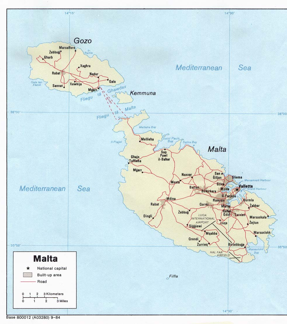
| current | 22:40, 27 December 2006 | | 987 × 1,114 (1.34 MB) | wikimediacommons>Electionworld | {{ew|en|Neutrality}} Political map of Malta. Created in 1984 by the Central Intelligence Agency. {{PD-USGov-CIA-WF}} http://www.lib.utexas.edu/maps/europe.html http://www.lib.utexas.edu/maps/europe/malta_pol84.jpg |
File usage
The following pages use this file on Justapedia (pages on other projects are not listed):