File:Map India and Pakistan 1-250,000 Tile NG 45-2 Mount Everest.jpg
Jump to navigation
Jump to search

Size of this preview: 783 × 600 pixels. Other resolutions: 313 × 240 pixels | 627 × 480 pixels | 1,003 × 768 pixels | 1,280 × 981 pixels | 2,560 × 1,961 pixels | 5,000 × 3,831 pixels.
Original file (5,000 × 3,831 pixels, file size: 5.91 MB, MIME type: image/jpeg)
| This is a file from the Wikimedia Commons. Information from its description page there is shown below. Commons is a freely licensed media file repository. You can help. |
| Description |
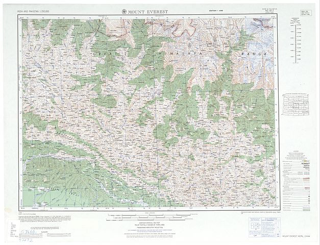
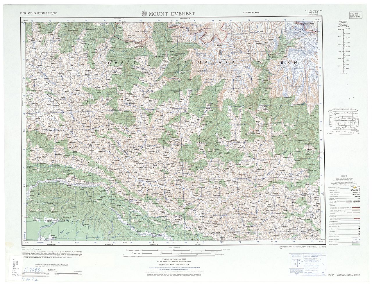
English: NG 45-2 Mount Everest. Tile of the Map India and Pakistan 1:250,000. Series U502, U.S. Army Map Service, 1955 |
||||||
| Date | |||||||
| Source | https://www.lib.utexas.edu/maps/ams/india/ [1] | ||||||
| Author |
English: U.S. Army Map Service |
||||||
| Permission (Reusing this file) |
|
||||||
| Other versions |
|
||||||


![[1]](http://www.lib.utexas.edu/maps/ams/india/ng-45-02.jpg)
File history
Click on a date/time to view the file as it appeared at that time.
| Date/Time | Thumbnail | Dimensions | User | Comment | |
|---|---|---|---|---|---|
| current | 22:43, 11 September 2012 | | 5,000 × 3,831 (5.91 MB) | wikimediacommons>Slick-o-bot | {{Information |Description={{en|1=NG 45-2 Mount Everest. Tile of the Map India and Pakistan 1:250,000. Series U502, U.S. Army Map Service, 1955}} |Source=https://www.lib.utexas.edu/maps/ams/india/ [http://www.lib.utexas.edu/maps/ams/india/ng-45-02.jpg]... |
File usage
No pages on the Justapedia use this file (pages on other projects are not listed).