File:London Underground with Greater London map.svg
Jump to navigation
Jump to search

Size of this PNG preview of this SVG file: 800 × 531 pixels. Other resolutions: 320 × 212 pixels | 640 × 425 pixels | 1,024 × 680 pixels | 1,280 × 849 pixels | 2,560 × 1,699 pixels | 1,296 × 860 pixels.
Original file (SVG file, nominally 1,296 × 860 pixels, file size: 1.17 MB)
| This is a file from the Wikimedia Commons. Information from its description page there is shown below. Commons is a freely licensed media file repository. You can help. |
Summary
| Description |
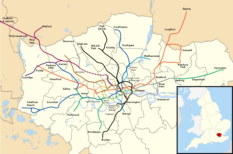
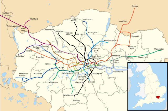
English: The London Underground system and the Greater London Boroughs. Please note this is very much a draft at the moment. |
| Date | |
| Source | File:London_Underground_full_map_complete.svg and File:Greater London UK district map (blank).svg |
| Author | authors of the above, modified by me |
.svg)
Licensing
This file is licensed under the Creative Commons Attribution-Share Alike 3.0 Unported license.
- You are free:
- to share – to copy, distribute and transmit the work
- to remix – to adapt the work
- Under the following conditions:
- attribution – You must give appropriate credit, provide a link to the license, and indicate if changes were made. You may do so in any reasonable manner, but not in any way that suggests the licensor endorses you or your use.
- share alike – If you remix, transform, or build upon the material, you must distribute your contributions under the same or compatible license as the original.
File history
Click on a date/time to view the file as it appeared at that time.
| Date/Time | Thumbnail | Dimensions | User | Comment | |
|---|---|---|---|---|---|
| current | 01:12, 22 September 2021 | | 1,296 × 860 (1.17 MB) | wikimediacommons>HarJIT | Battersea extension |
File usage
The following pages use this file on Justapedia (pages on other projects are not listed):