File:Locator map of Arrondissement Amiens 2019.png
Jump to navigation
Jump to search
Size of this preview: 607 × 600 pixels. Other resolutions: 243 × 240 pixels | 486 × 480 pixels | 777 × 768 pixels | 1,036 × 1,024 pixels | 2,500 × 2,471 pixels.
Original file (2,500 × 2,471 pixels, file size: 1.65 MB, MIME type: image/png)
| This is a file from the Wikimedia Commons. Information from its description page there is shown below. Commons is a freely licensed media file repository. You can help. |
Summary
| Description |
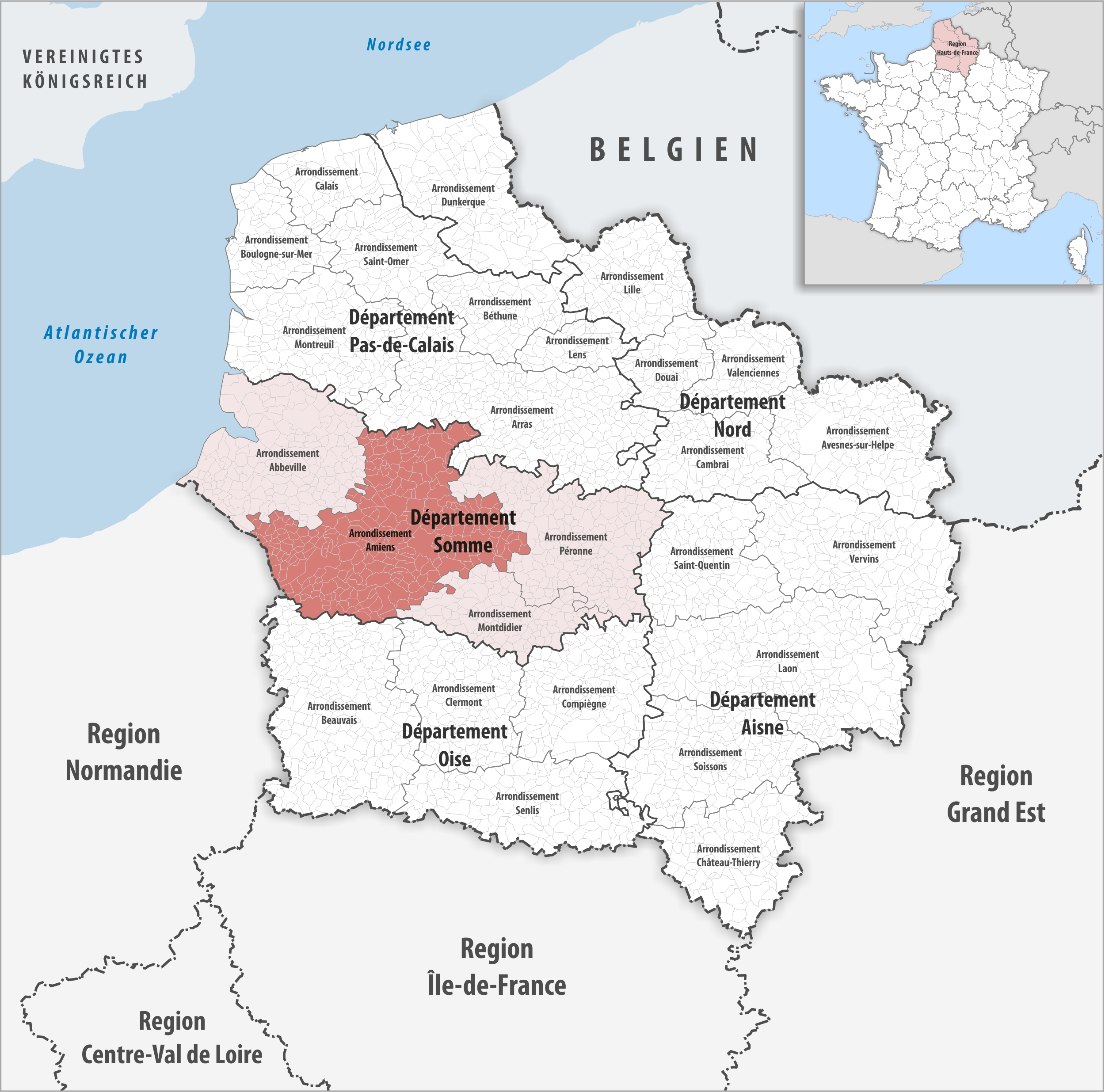
Deutsch: Lage des Arrondissements Amiens |
||||||||
| Date | |||||||||
| Source | Own work | ||||||||
| Author | Tschubby | ||||||||
| Permission (Reusing this file) |
I, the copyright holder of this work, hereby publish it under the following licenses:
This file is licensed under the Creative Commons Attribution-Share Alike 2.5 Generic, 2.0 Generic and 1.0 Generic license.
You may select the license of your choice. |

File history
Click on a date/time to view the file as it appeared at that time.
| Date/Time | Thumbnail | Dimensions | User | Comment | |
|---|---|---|---|---|---|
| current | 17:25, 6 November 2019 | | 2,500 × 2,471 (1.65 MB) | wikimediacommons>Tschubby | {{Information |description= |date= |source= |author= |permission= |other versions= }} |
File usage
No pages on the Justapedia use this file (pages on other projects are not listed).
Metadata
BoilerPlate was here