File:Location map of Vermilion County, Illinois.svg
Jump to navigation
Jump to search

Size of this PNG preview of this SVG file: 600 × 600 pixels. Other resolutions: 240 × 240 pixels | 480 × 480 pixels | 768 × 768 pixels | 1,024 × 1,024 pixels | 2,048 × 2,048 pixels.
Original file (SVG file, nominally 768 × 768 pixels, file size: 210 KB)
| This is a file from the Wikimedia Commons. Information from its description page there is shown below. Commons is a freely licensed media file repository. You can help. |
Summary
| Description |
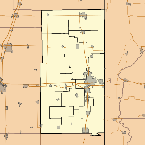
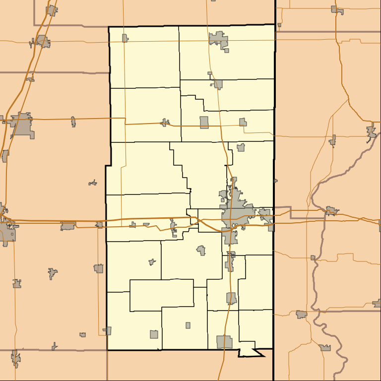
English: This is a map of Vermilion County, Illinois, USA which includes township borders. |
| Date | |
| Source | My own work, using custom-written MapScript applications with National Atlas and United States Census Bureau data |
| Author | Omnedon |
Licensing
| I, the copyright holder of this work, release this work into the public domain. This applies worldwide. In some countries this may not be legally possible; if so: I grant anyone the right to use this work for any purpose, without any conditions, unless such conditions are required by law. |
File history
Click on a date/time to view the file as it appeared at that time.
| Date/Time | Thumbnail | Dimensions | User | Comment | |
|---|---|---|---|---|---|
| current | 07:52, 21 August 2010 | | 768 × 768 (210 KB) | wikimediacommons>Omnedon | == {{int:filedesc}} == {{Information |Description={{en|This is a map of Vermilion County, Illinois, USA which includes township borders.}} |Source=My own work, using custom-written MapScript applications with [http://www. |
File usage
No pages on the Justapedia use this file (pages on other projects are not listed).