File:Landkarte von Schlesien.jpg
Jump to navigation
Jump to search
Size of this preview: 800 × 560 pixels. Other resolutions: 320 × 224 pixels | 640 × 448 pixels | 1,024 × 717 pixels | 1,280 × 896 pixels | 2,169 × 1,518 pixels.
Original file (2,169 × 1,518 pixels, file size: 1.28 MB, MIME type: image/jpeg)
| This is a file from the Wikimedia Commons. Information from its description page there is shown below. Commons is a freely licensed media file repository. You can help. |
Summary
| Description |
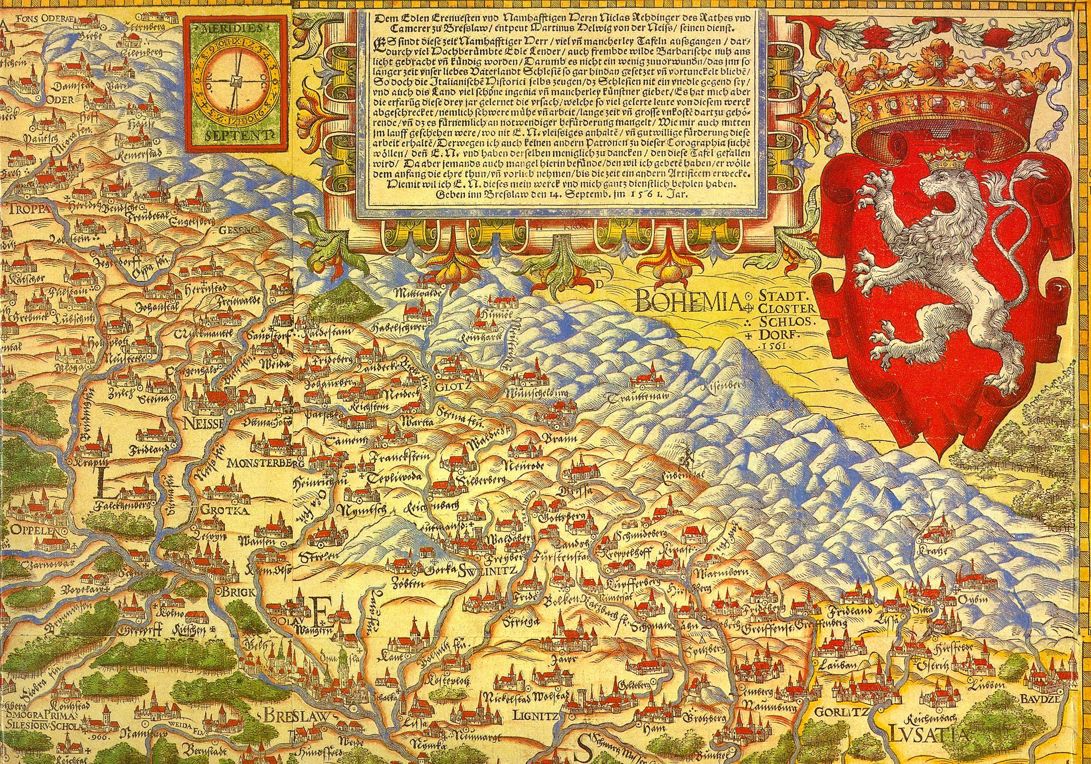
English: First map of Silesia |
| Date | |
| Source | Self-scanned |
| Author | Martin Helwig |
Licensing
|
This work is in the public domain in its country of origin and other countries and areas where the copyright term is the author's life plus 100 years or fewer. | |
| This file has been identified as being free of known restrictions under copyright law, including all related and neighboring rights. | |
File history
Click on a date/time to view the file as it appeared at that time.
| Date/Time | Thumbnail | Dimensions | User | Comment | |
|---|---|---|---|---|---|
| current | 20:39, 29 August 2006 | | 2,169 × 1,518 (1.28 MB) | wikimediacommons>Hermannthomas | {{Information |Description=Erste Landkarte von Schlesien |Source= |Date=1561 |Author=Martin Helwig |Permission= |other_versions= }} |
File usage
The following pages use this file on Justapedia (pages on other projects are not listed):