File:Koppen-Geiger Map GHA present.svg
Jump to navigation
Jump to search

Size of this PNG preview of this SVG file: 752 × 600 pixels. Other resolutions: 301 × 240 pixels | 602 × 480 pixels | 963 × 768 pixels | 1,280 × 1,021 pixels | 2,560 × 2,041 pixels | 1,066 × 850 pixels.
Original file (SVG file, nominally 1,066 × 850 pixels, file size: 510 KB)
| This is a file from the Wikimedia Commons. Information from its description page there is shown below. Commons is a freely licensed media file repository. You can help. |
File history
Click on a date/time to view the file as it appeared at that time.
| Date/Time | Thumbnail | Dimensions | User | Comment | |
|---|---|---|---|---|---|
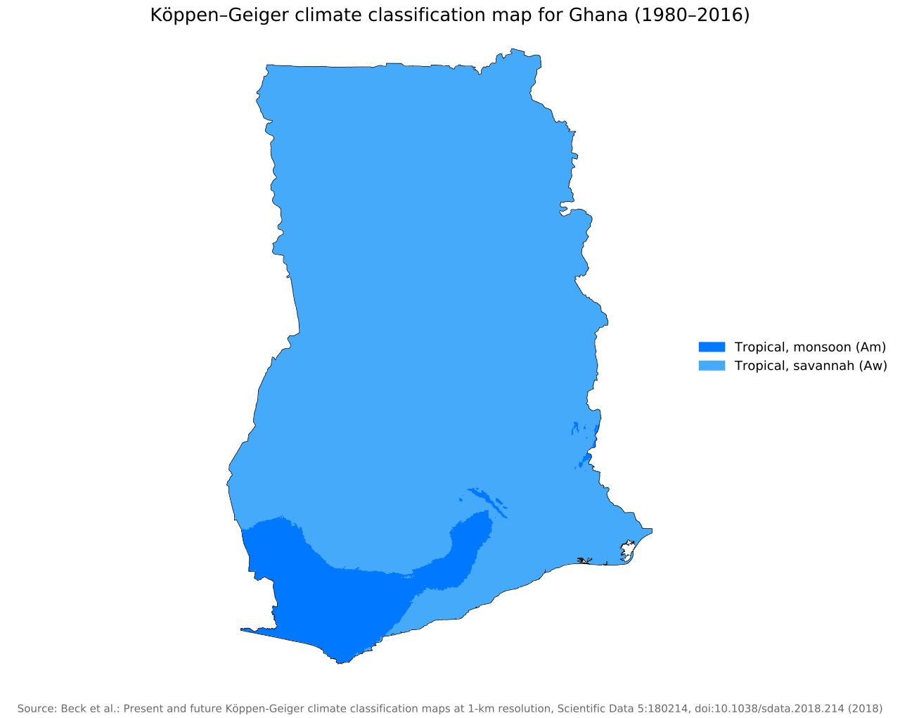
| current | 08:50, 26 November 2018 | | 1,066 × 850 (510 KB) | wikimediacommons>NVergopolan | {{Information |Description={{en| Köppen–Geiger climate classification map for Ghana}}|date=2018-11-06|source={{cite journal | title=Present and future Köppen-Geiger climate classification maps at 1-km resolution | journal=Nature Scientific Data |doi=10.1038/sdata.2018.214}}|author=Beck, H.E., Zimmermann, N. E., McVicar, T. R., Vergopolan, N., Berg, A., & Wood, E. F.|permission=|other_versions=|other_fields=}}{{Cc-by-4.0}}{{Location|7.95602536|-1.03182453}}[[Category:Köppen-Geiger Climate Clas... |
File usage
The following pages use this file on Justapedia (pages on other projects are not listed):