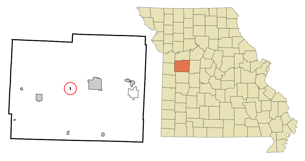
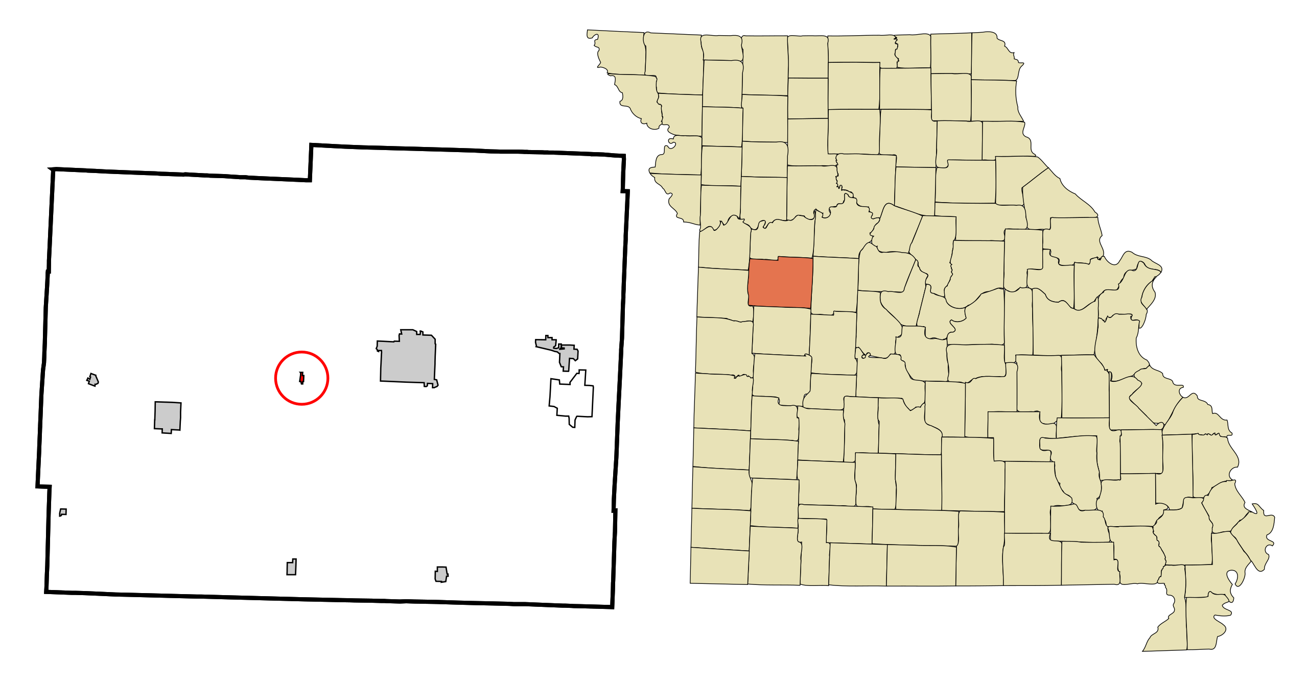
File:Johnson County Missouri Incorporated and Unincorporated areas Centerview Highlighted.svg
Jump to navigation
Jump to search

Size of this PNG preview of this SVG file: 800 × 421 pixels. Other resolutions: 320 × 168 pixels | 640 × 337 pixels | 1,024 × 539 pixels | 1,280 × 674 pixels | 2,560 × 1,347 pixels | 950 × 500 pixels.
Original file (SVG file, nominally 950 × 500 pixels, file size: 131 KB)
| This is a file from the Wikimedia Commons. Information from its description page there is shown below. Commons is a freely licensed media file repository. You can help. |
File history
Click on a date/time to view the file as it appeared at that time.
| Date/Time | Thumbnail | Dimensions | User | Comment | |
|---|---|---|---|---|---|
| current | 23:54, 24 October 2007 | | 950 × 500 (131 KB) | wikimediacommons>ArkyBot~commonswiki | {{Information |Description=This map shows the incorporated and unincorporated areas in Johnson County, Missouri, highlighting Centerview in red. It was |
File usage
No pages on the Justapedia use this file (pages on other projects are not listed).