File:Io map regio labeled.jpg
Jump to navigation
Jump to search
Size of this preview: 800 × 400 pixels. Other resolutions: 320 × 160 pixels | 640 × 320 pixels | 1,024 × 512 pixels | 1,280 × 640 pixels | 2,560 × 1,280 pixels | 4,096 × 2,048 pixels.
Original file (4,096 × 2,048 pixels, file size: 1.54 MB, MIME type: image/jpeg)
| This is a file from the Wikimedia Commons. Information from its description page there is shown below. Commons is a freely licensed media file repository. You can help. |
Summary
| Description |
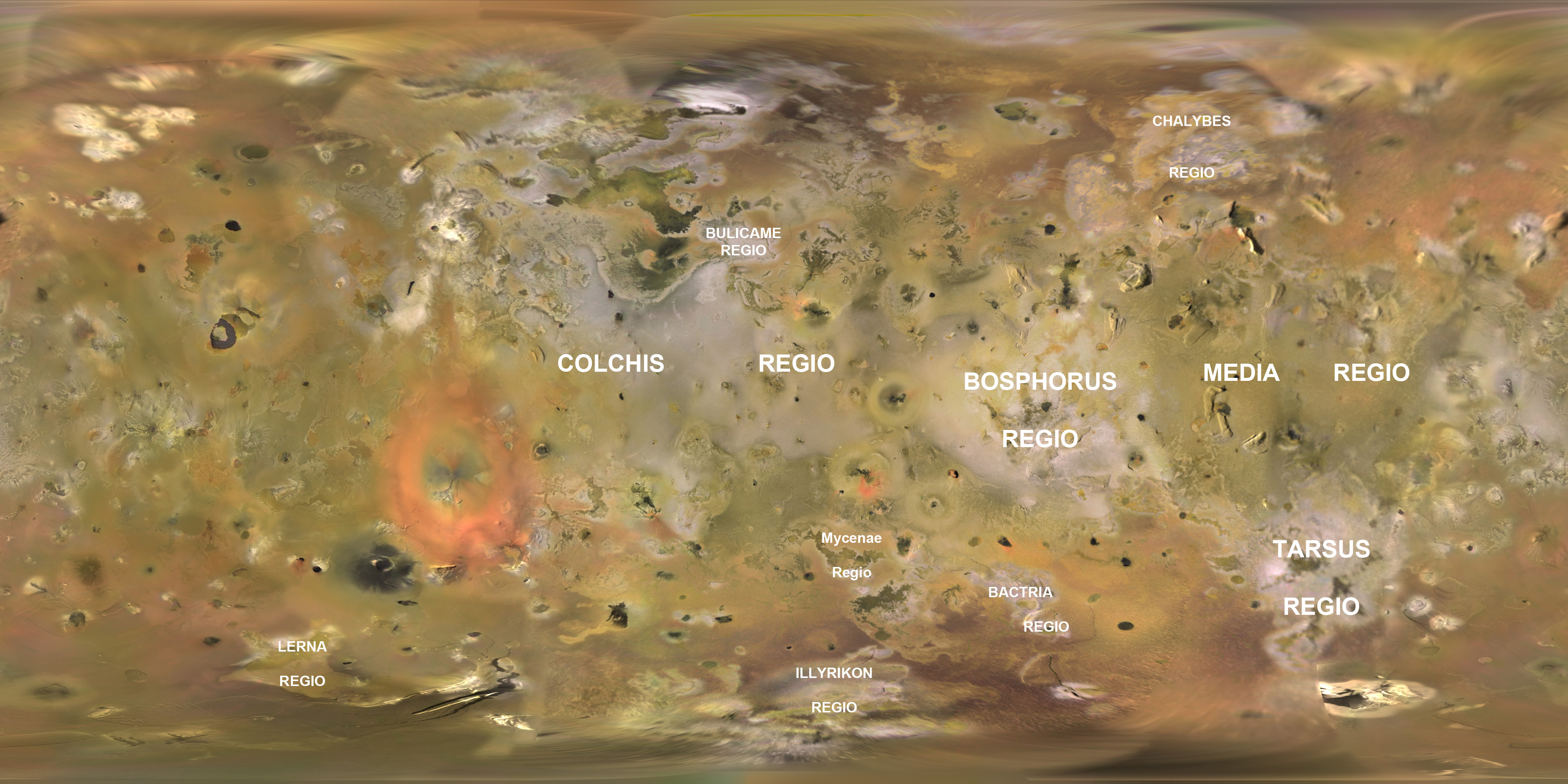
English: Base map of Jupiter's moon Io created from Voyager and Galileo imagery. Original map created by the USGS Astrogeology group in Flagstaff, Arizona. Labels for regions on Io added by Submitter. |
|||||
| Date | ||||||
| Source | https://astrogeology.usgs.gov/Projects/JupiterSatellites/io.html | |||||
| Author | NASA/JPL/USGS/Jason Perry | |||||
| Permission (Reusing this file) |
|
Licensing
| This file is in the public domain in the United States because it was solely created by NASA. NASA copyright policy states that "NASA material is not protected by copyright unless noted". (See Template:PD-USGov, NASA copyright policy page or JPL Image Use Policy.) | ||
 |
Warnings:
|
File history
Click on a date/time to view the file as it appeared at that time.
| Date/Time | Thumbnail | Dimensions | User | Comment | |
|---|---|---|---|---|---|
| current | 01:13, 3 February 2010 | | 4,096 × 2,048 (1.54 MB) | wikimediacommons>Volcanopele | Corrected misspelling of Tarsus Regio |
File usage
No pages on the Justapedia use this file (pages on other projects are not listed).