File:Hurricane Fourteen surface analysis 18 Oct 1916.jpg
Jump to navigation
Jump to search

Size of this preview: 656 × 600 pixels. Other resolutions: 263 × 240 pixels | 525 × 480 pixels | 720 × 658 pixels.
Original file (720 × 658 pixels, file size: 120 KB, MIME type: image/jpeg)
| This is a file from the Wikimedia Commons. Information from its description page there is shown below. Commons is a freely licensed media file repository. You can help. |
Summary
| Description |
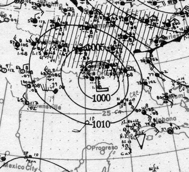
English: Surface weather analysis of the fourteenth storm of the 1916 Atlantic hurricane season approaching landfall on the U.S. Gulf Coast as a Category 2 hurricane on October 18, 1916. |
| Date | |
| Source | NOAA AOML Hurricane Research Division Weathermaps ("191614oct18.jpg") |
| Author | NOAA, AOML |
Licensing
This image is in the public domain because it contains materials that originally came from the U.S. National Oceanic and Atmospheric Administration, taken or made as part of an employee's official duties.
|
File history
Click on a date/time to view the file as it appeared at that time.
| Date/Time | Thumbnail | Dimensions | User | Comment | |
|---|---|---|---|---|---|
| current | 20:17, 25 March 2020 | | 720 × 658 (120 KB) | wikimediacommons>TheAustinMan | Uploaded a work by NOAA, AOML from [https://www.aoml.noaa.gov/hrd/hurdat/weathermaps/ NOAA AOML Hurricane Research Division Weathermaps] ("191614oct18.jpg") with UploadWizard |
File usage
No pages on the Justapedia use this file (pages on other projects are not listed).