File:Hudson River Connecting Railroad map.svg
Jump to navigation
Jump to search

Size of this PNG preview of this SVG file: 121 × 188 pixels. Other resolutions: 154 × 240 pixels | 309 × 480 pixels | 494 × 768 pixels | 659 × 1,024 pixels | 1,318 × 2,048 pixels.
Original file (SVG file, nominally 121 × 188 pixels, file size: 32 KB)
| This is a file from the Wikimedia Commons. Information from its description page there is shown below. Commons is a freely licensed media file repository. You can help. |
Summary

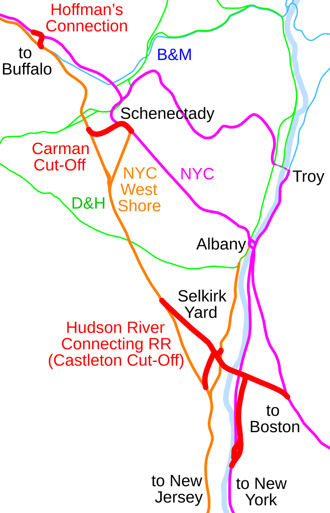
Map of the Hudson River Connecting Railroad and other New York Central Railroad connections near Albany, New York. Traced on USGS topos.
Licensing
| This work has been released into the public domain by its author, SPUI. This applies worldwide. In some countries this may not be legally possible; if so: |
File history
Click on a date/time to view the file as it appeared at that time.
| Date/Time | Thumbnail | Dimensions | User | Comment | |
|---|---|---|---|---|---|
| current | 15:30, 16 October 2005 | | 121 × 188 (32 KB) | wikimediacommons>SPUI~commonswiki | text alignment issues |
File usage
No pages on the Justapedia use this file (pages on other projects are not listed).