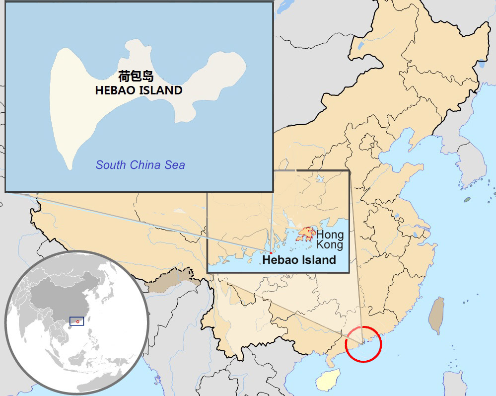
File:Hebao island map.jpg
Jump to navigation
Jump to search
Size of this preview: 752 × 600 pixels. Other resolutions: 301 × 240 pixels | 602 × 480 pixels | 999 × 797 pixels.
Original file (999 × 797 pixels, file size: 156 KB, MIME type: image/jpeg)
| This is a file from the Wikimedia Commons. Information from its description page there is shown below. Commons is a freely licensed media file repository. You can help. |
File history
Click on a date/time to view the file as it appeared at that time.
| Date/Time | Thumbnail | Dimensions | User | Comment | |
|---|---|---|---|---|---|
| current | 20:13, 3 October 2010 | | 999 × 797 (156 KB) | wikimediacommons>Christinebenson58 | {{Information |Description={{en|1=Map showing Hong Kong's location in Asia, on China's south coast, and Hong Kong's 18 disctricts}} {{fr|1=Carte de Hong Kong : situation en Asie, situation sur le littoral chinois, carte des 18 disctricts}} |Source=*[[:Fil |
File usage
No pages on the Justapedia use this file (pages on other projects are not listed).