DescriptionGreater Jerusalem May 2006 CIA remote-sensing map.jpg
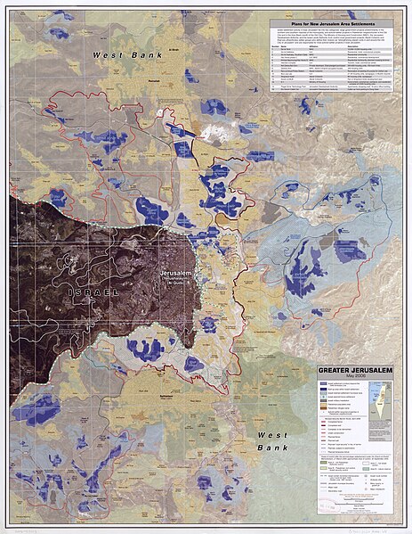
English: Greater Jerusalem, May 2006.
United States. Central Intelligence Agency.
CREATED/PUBLISHED
[Washington, D.C.] : Central Intelligence Agency, [2006]
NOTES
Shows settlements, refugee camps, fences, walls, etc.
"Imagery base: SPOT 5 multispectral imagery acquired July 2004."
Includes chart describing plans for new settlements.
"803197AI (G00307) 5-06."
Scale 1:40,000 ; universal transverse Mercator proj. (E 35006'--E 35021'/N 31054'--N 310390).
MEDIUM
1 remote-sensing map : col. ; 87 x 67 cm.
CALL NUMBER
G7504.J4G4 2006 .U5
REPOSITORY
Library of Congress Geography and Map Division Washington, D.C. 20540-4650 USA
DIGITAL ID
g7504j ct001915 http://hdl.loc.gov/loc.gmd/g7504j.ct001915
{{Information |Description={{en|1=Greater Jerusalem, May 2006. United States. Central Intelligence Agency. CREATED/PUBLISHED [Washington, D.C.] : Central Intelligence Agency, [2006] NOTES Shows settlements, refugee camps, fences, walls, etc. "Imagery ba
File usage
No pages on the Justapedia use this file (pages on other projects are not listed).
Metadata
This file contains additional information, probably added from the digital camera or scanner used to create or digitize it.
If the file has been modified from its original state, some details may not fully reflect the modified file.


