File:Enceinte gallo-romaine Nantes detail.jpg
Jump to navigation
Jump to search
Size of this preview: 800 × 450 pixels. Other resolutions: 320 × 180 pixels | 640 × 360 pixels | 1,024 × 576 pixels | 1,280 × 720 pixels | 1,920 × 1,080 pixels.
Original file (1,920 × 1,080 pixels, file size: 778 KB, MIME type: image/jpeg)
| This is a file from the Wikimedia Commons. Information from its description page there is shown below. Commons is a freely licensed media file repository. You can help. |
Summary
| Description |
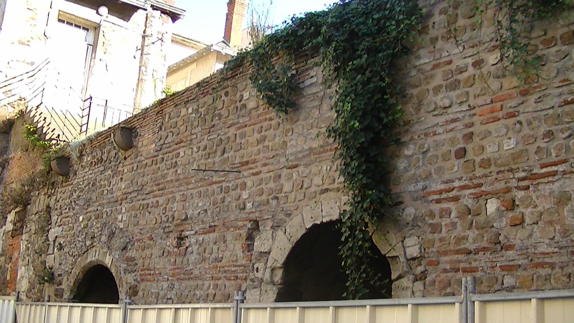
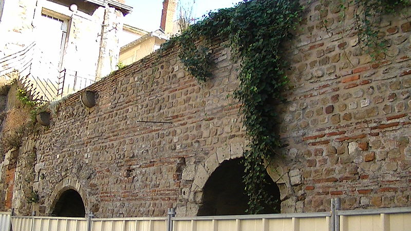
English: Detail of the remnants of the Gallo-Roman wall of Nantes, in the former Couvent des Cordeliers, now the École primaire Saint-Pierre
|
|||
| Date | ||||
| Source | Own work | |||
| Author | Adam Bishop | |||
| Permission (Reusing this file) |
This building is not subject to copyright. Built in the 4th century, architect unknown.
|

| Camera location | | View this and other nearby images on: OpenStreetMap |
|---|
Licensing
I, the copyright holder of this work, hereby publish it under the following license:
This file is licensed under the Creative Commons Attribution-Share Alike 3.0 Unported license.
- You are free:
- to share – to copy, distribute and transmit the work
- to remix – to adapt the work
- Under the following conditions:
- attribution – You must give appropriate credit, provide a link to the license, and indicate if changes were made. You may do so in any reasonable manner, but not in any way that suggests the licensor endorses you or your use.
- share alike – If you remix, transform, or build upon the material, you must distribute your contributions under the same or compatible license as the original.
File history
Click on a date/time to view the file as it appeared at that time.
| Date/Time | Thumbnail | Dimensions | User | Comment | |
|---|---|---|---|---|---|
| current | 20:01, 3 October 2011 | | 1,920 × 1,080 (778 KB) | wikimediacommons>Adam Bishop |
File usage
No pages on the Justapedia use this file (pages on other projects are not listed).