File:East Timor municipalities names 2003-2015.png
Jump to navigation
Jump to search

Size of this preview: 800 × 354 pixels. Other resolutions: 320 × 141 pixels | 640 × 283 pixels | 1,024 × 453 pixels | 2,000 × 884 pixels.
Original file (2,000 × 884 pixels, file size: 184 KB, MIME type: image/png)
| This is a file from the Wikimedia Commons. Information from its description page there is shown below. Commons is a freely licensed media file repository. You can help. |
File history
Click on a date/time to view the file as it appeared at that time.
| Date/Time | Thumbnail | Dimensions | User | Comment | |
|---|---|---|---|---|---|
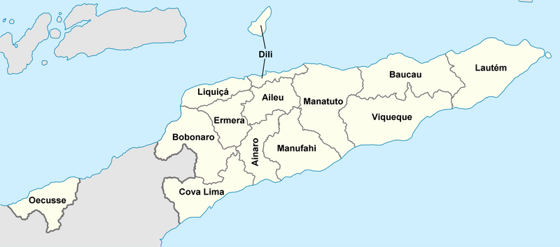
| current | 10:38, 1 July 2010 | | 2,000 × 884 (184 KB) | wikimediacommons>J. Patrick Fischer | {{Information |Description={{de|Lagekarte des Distrikte Osttimors}} {{en|Locator map of districts of East Timor}} |Source=*File:East_Timor_Aileu_locator_map.svg |Date=2010-07-01 06:35 (UTC) |Author=*File:East_Timor_Aileu_locator_map.svg: [[Us |
File usage
No pages on the Justapedia use this file (pages on other projects are not listed).