File:Duitstalige GemeenschapLocatie.png
Jump to navigation
Jump to search
No higher resolution available.
Duitstalige_GemeenschapLocatie.png (270 × 270 pixels, file size: 1 KB, MIME type: image/png)
| This is a file from the Wikimedia Commons. Information from its description page there is shown below. Commons is a freely licensed media file repository. You can help. |

|
File:Deutschsprachige Gemeinschaft in Belgium.svg is a vector version of this file. It should be used in place of this PNG file when not inferior.
File:Duitstalige GemeenschapLocatie.png → File:Deutschsprachige Gemeinschaft in Belgium.svg
For more information, see Help:SVG. |
 |
Summary
| Description |
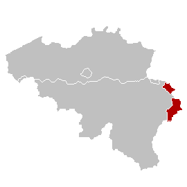
Deutsch: Lage der Deutschsprachigen Gemeinschaft Belgiens, Kanton Eupen im Norden, Kanton St.Vith im Süden.
English: map of Belgium showing the autonomous "German Speaking Community" in red.
Nederlands: kaart gemaakt door w:nl:gebruiker:LennartBolks in in het publieke domein geplaatst.
Walon : mape del Beldjike, avou l' Kiminålté Tîxhon-Cåzante e rodje coleur. |
| Date | |
| Source | Own work |
| Author | LennartBolks |
Licensing
| This work has been released into the public domain by its author, LennartBolks. This applies worldwide. In some countries this may not be legally possible; if so: |
File history
Click on a date/time to view the file as it appeared at that time.
| Date/Time | Thumbnail | Dimensions | User | Comment | |
|---|---|---|---|---|---|
| current | 01:05, 21 April 2007 | | 270 × 270 (1 KB) | wikimediacommons>Tene~commonswiki | Optimised (0) |
File usage
No pages on the Justapedia use this file (pages on other projects are not listed).