File:Division de La Habana en.svg

Original file (SVG file, nominally 519 × 923 pixels, file size: 191 KB)
| This is a file from the Wikimedia Commons. Information from its description page there is shown below. Commons is a freely licensed media file repository. You can help. |
![]() ✗
The source code of this SVG is invalid due to 69 errors.
✗
The source code of this SVG is invalid due to 69 errors.
Summary
| Description |
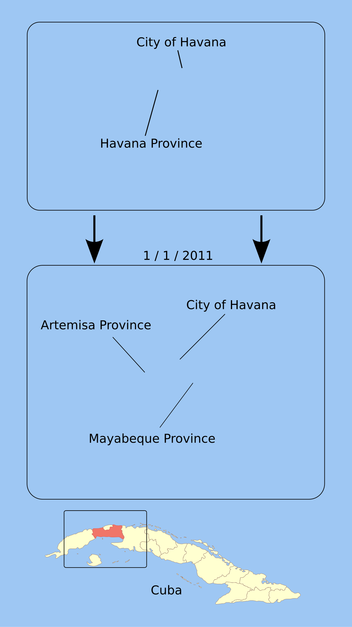
Map diagramming the division of the La Habana province in Cuba into Mayabeque province and Artemisa province, including a note on the (separate) city of Havana whose suburbs this area contains. Note: This map was drawn with the understanding that La Habana was simply being divided, but it's been pointed out that this is incorrect: the western border of Artemisa is moving further west than the western border of La Habana, and will in fact capture several counties from Pinar Del Rio province. This is awaiting correction. |
|---|---|
| Source |
I (Lesqual (talk)) created this work entirely by myself from public domain sources including NED and Image:Mayabeq_mapa.jpg. |
| Date |
17:20, 22 August 2010 (UTC) |
| Author | |
| Permission (Reusing this file) |
See below. |
| Other versions | (es) |
Licensing
| I, the copyright holder of this work, hereby release it into the public domain. This applies worldwide. If this is not legally possible: |
 | This file is a candidate to be copied to Wikimedia Commons.
Any user may perform this transfer; refer to Justapedia:Moving files to Commons for details. If this file has problems with attribution, copyright, or is otherwise ineligible for Commons, then remove this tag and DO NOT transfer it; repeat violators may be blocked from editing. Other Instructions
| ||
| |||
Summary
| Description |
English: Map diagramming the division of the La Habana province in Cuba into Mayabeque province and Artemisa province, including a note on the (separate) city of Havana whose suburbs this area contains. Note: This map was drawn with the understanding that La Habana was simply being divided, but it's been pointed out that this is incorrect: the western border of Artemisa is moving further west than the western border of La Habana, and will in fact capture several counties from Pinar Del Rio province. This is awaiting correction. |
| Date | |
| Source | Own work based on: Mayabeq mapa.jpg, and NED |
| Author | Lesqual (talk) |
| Other versions |
|
| SVG development | This W3C-invalid diagram was created with Qt. This diagram uses embedded text that can be easily translated using a text editor. |

Licensing
| This work has been released into the public domain by its author, Lesqual. This applies worldwide. In some countries this may not be legally possible; if so: Lesqual grants anyone the right to use this work for any purpose, without any conditions, unless such conditions are required by law. |
File history
Click on a date/time to view the file as it appeared at that time.
| Date/Time | Thumbnail | Dimensions | User | Comment | |
|---|---|---|---|---|---|
| current | 07:26, 2 September 2010 | | 519 × 923 (191 KB) | wikimediacommons>Lesqual | Fonts in base-level group again |