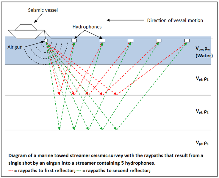
File:Diagram of a marine seismic survey.png
Jump to navigation
Jump to search

Size of this preview: 736 × 599 pixels. Other resolutions: 295 × 240 pixels | 590 × 480 pixels | 786 × 640 pixels.
Original file (786 × 640 pixels, file size: 50 KB, MIME type: image/png)
| This is a file from the Wikimedia Commons. Information from its description page there is shown below. Commons is a freely licensed media file repository. You can help. |
File history
Click on a date/time to view the file as it appeared at that time.
| Date/Time | Thumbnail | Dimensions | User | Comment | |
|---|---|---|---|---|---|
| current | 19:46, 28 February 2012 | | 786 × 640 (50 KB) | wikimediacommons>Nwhit |
File usage
No pages on the Justapedia use this file (pages on other projects are not listed).