File:Derbent Khanate.png
Jump to navigation
Jump to search

Size of this preview: 600 × 600 pixels. Other resolutions: 240 × 240 pixels | 480 × 480 pixels | 768 × 768 pixels | 1,024 × 1,024 pixels | 2,048 × 2,048 pixels | 2,600 × 2,600 pixels.
Original file (2,600 × 2,600 pixels, file size: 827 KB, MIME type: image/png)
| This is a file from the Wikimedia Commons. Information from its description page there is shown below. Commons is a freely licensed media file repository. You can help. |
Summary
| Description |
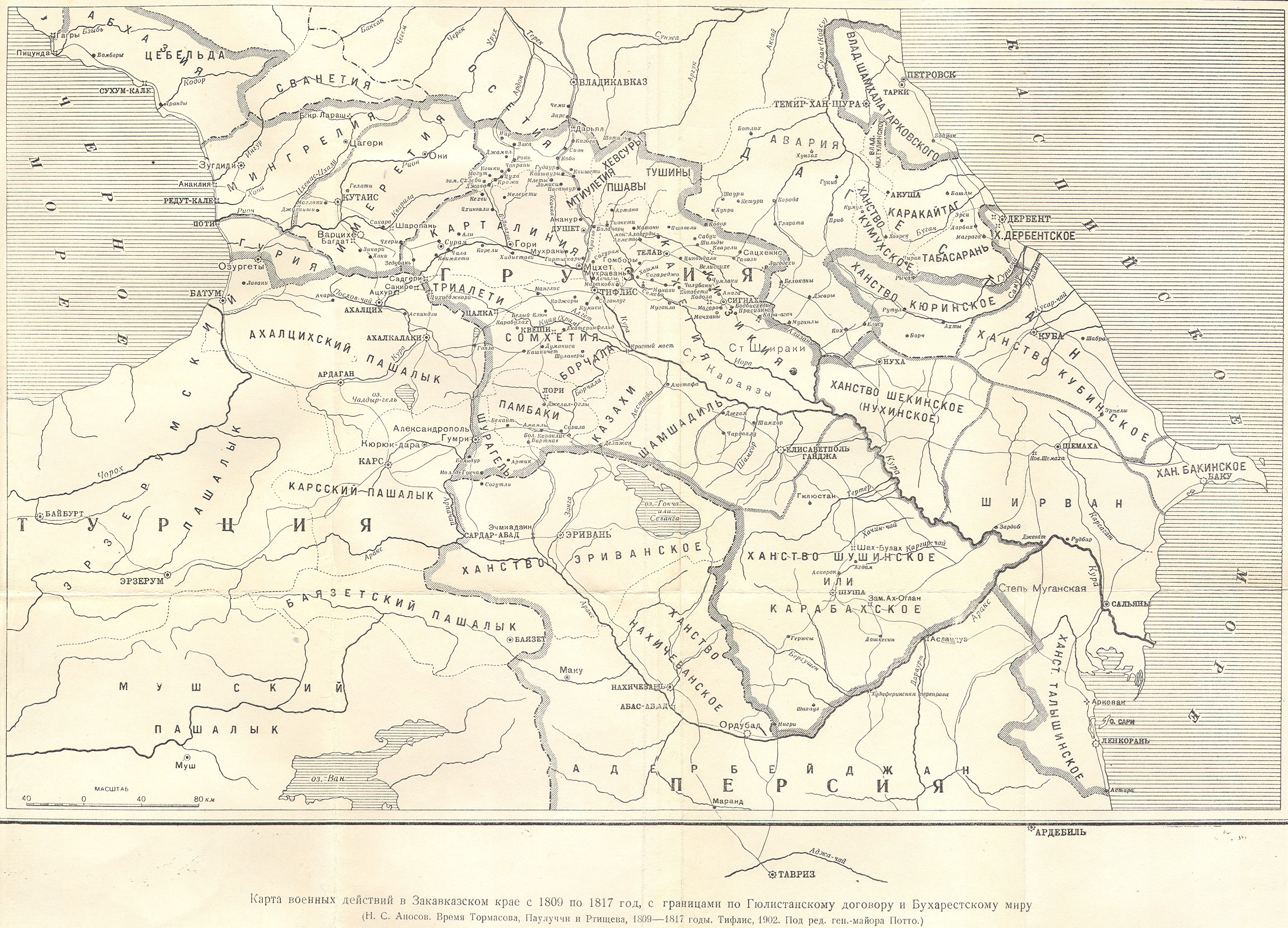
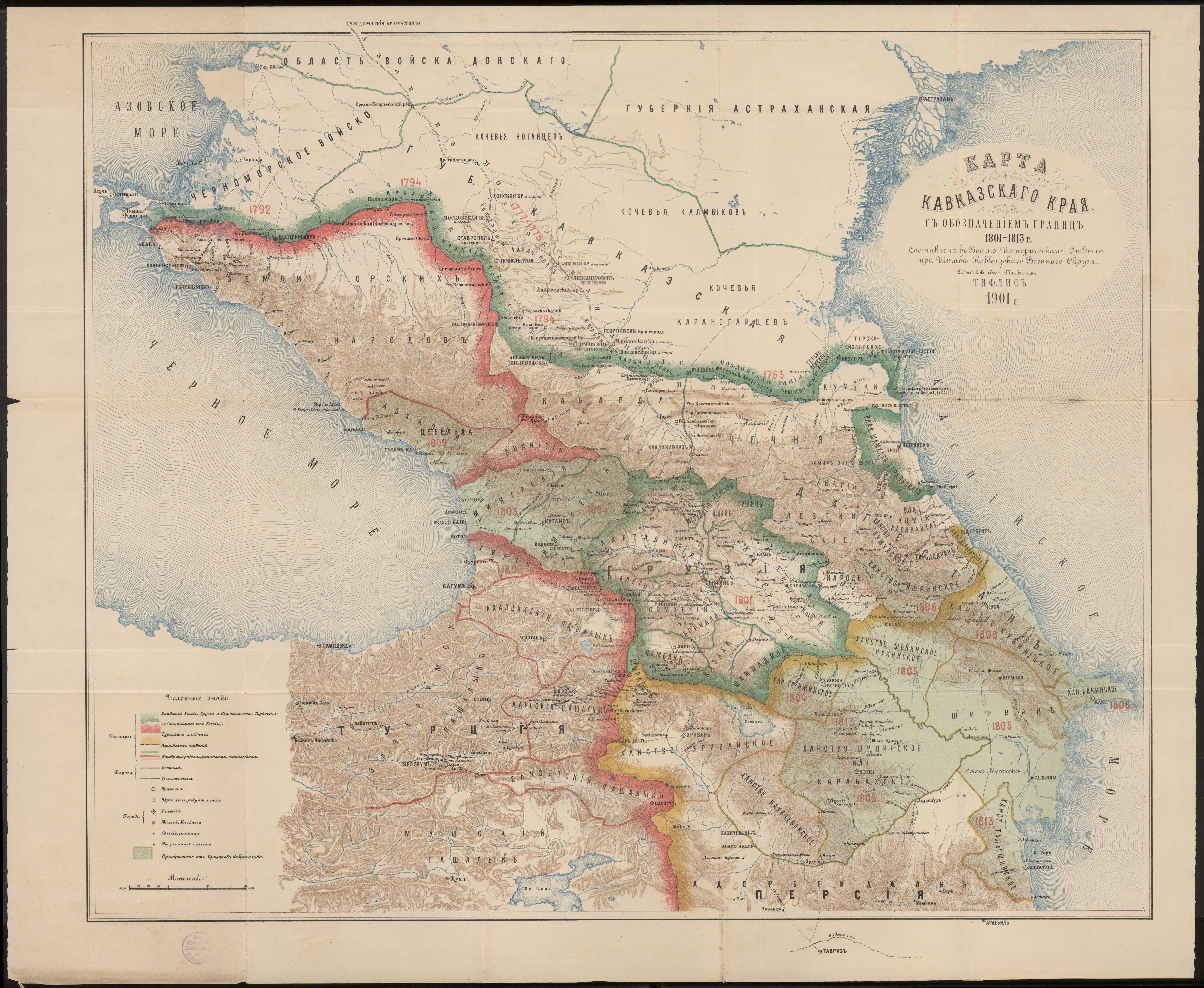
English: Map depicting Derbent Khanate, its surrounding territories and a smaller map on top-right showing location of the khanate in a greater scale |
| Date | |
| Source | Borders adapted from this map and this map |
| Author | Golden |
Licensing
I, the copyright holder of this work, hereby publish it under the following license:
This file is licensed under the Creative Commons Attribution-Share Alike 4.0 International license.
- You are free:
- to share – to copy, distribute and transmit the work
- to remix – to adapt the work
- Under the following conditions:
- attribution – You must give appropriate credit, provide a link to the license, and indicate if changes were made. You may do so in any reasonable manner, but not in any way that suggests the licensor endorses you or your use.
- share alike – If you remix, transform, or build upon the material, you must distribute your contributions under the same or compatible license as the original.
File history
Click on a date/time to view the file as it appeared at that time.
| Date/Time | Thumbnail | Dimensions | User | Comment | |
|---|---|---|---|---|---|
| current | 13:31, 28 August 2020 | | 2,600 × 2,600 (827 KB) | wikimediacommons>Golden | Uploaded own work with UploadWizard |
File usage
No pages on the Justapedia use this file (pages on other projects are not listed).