File:CraterHighlands Tanzania NASA.jpg
Jump to navigation
Jump to search
Size of this preview: 484 × 600 pixels. Other resolutions: 194 × 240 pixels | 540 × 669 pixels.
Original file (540 × 669 pixels, file size: 118 KB, MIME type: image/jpeg)
| This is a file from the Wikimedia Commons. Information from its description page there is shown below. Commons is a freely licensed media file repository. You can help. |
File history
Click on a date/time to view the file as it appeared at that time.
| Date/Time | Thumbnail | Dimensions | User | Comment | |
|---|---|---|---|---|---|
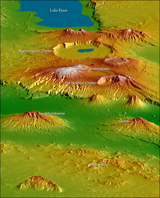
| current | 21:53, 28 April 2006 | | 540 × 669 (118 KB) | wikimediacommons>Holly Cheng | {{Information | Description=Topographical map of the w:Crater Highlands in Tanzania. Color indicates height, with lowest elevations in green and highest elevations in white. Shading shows the slope. The vertical relief has been exaggerated by a factor |
File usage
No pages on the Justapedia use this file (pages on other projects are not listed).