File:Chicago Elevated Map 1913.jpg
Jump to navigation
Jump to search

Size of this preview: 800 × 474 pixels. Other resolutions: 320 × 190 pixels | 640 × 379 pixels | 1,204 × 713 pixels.
Original file (1,204 × 713 pixels, file size: 262 KB, MIME type: image/jpeg)
| This is a file from the Wikimedia Commons. Information from its description page there is shown below. Commons is a freely licensed media file repository. You can help. |
Summary
| Description |
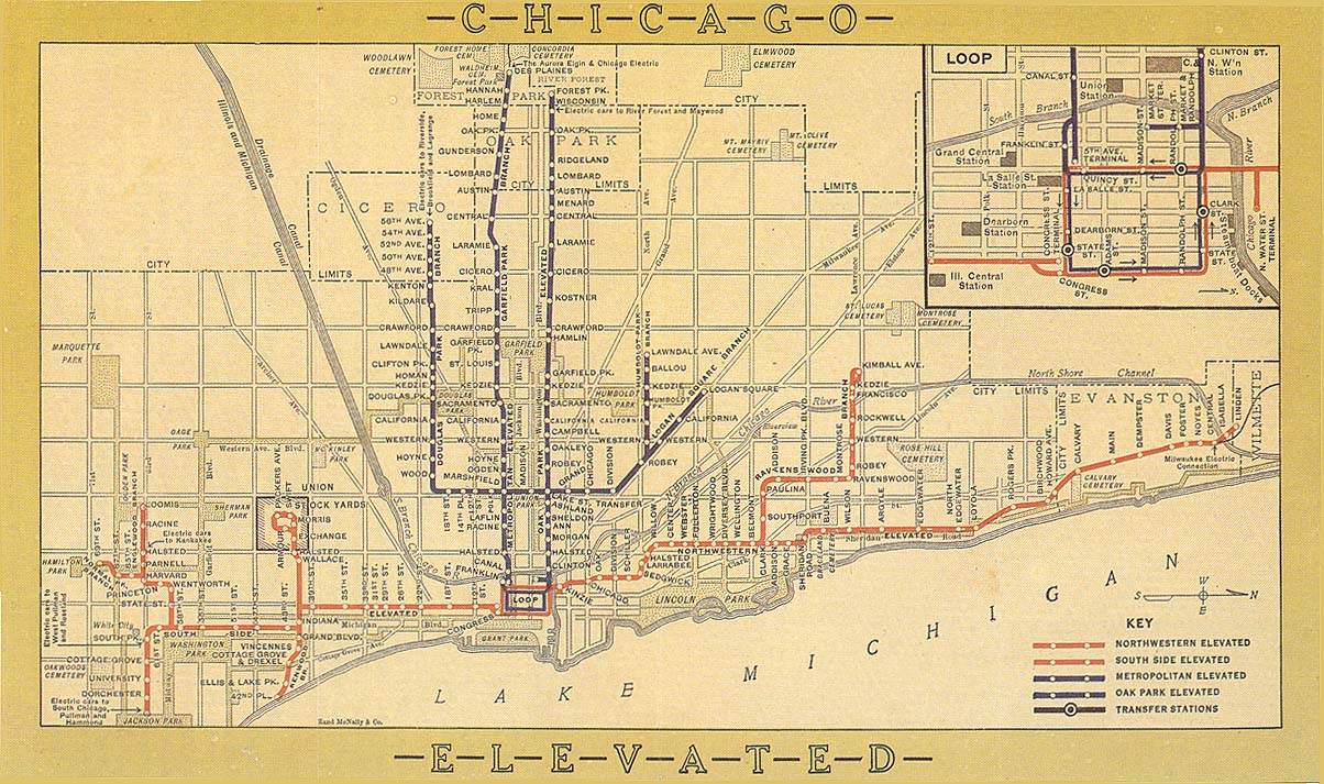
English: Map of elevated rapid transit lines in Chicago. Contains lines run by four companies; the Metropolitan West Side Elevated Railroad, South Side Elevated Railroad, Northwestern Elevated Railroad, and Oak Park Elevated Railroad. |
| Date | |
| Source | http://chicago-l.org/maps/route/maps/1913map.jpg Map at Chicago-L.org |
| Author | Chicago Elevated Railways |
Licensing
This media file is in the public domain in the United States. This applies to U.S. works where the copyright has expired, often because its first publication occurred prior to January 1, 1929, and if not then due to lack of notice or renewal. See this page for further explanation.
|
 | |
 |
This image might not be in the public domain outside of the United States; this especially applies in the countries and areas that do not apply the rule of the shorter term for US works, such as Canada, Mainland China (not Hong Kong or Macao), Germany, Mexico, and Switzerland. The creator and year of publication are essential information and must be provided. See Wikipedia:Public domain and Wikipedia:Copyrights for more details.
|
File history
Click on a date/time to view the file as it appeared at that time.
| Date/Time | Thumbnail | Dimensions | User | Comment | |
|---|---|---|---|---|---|
| current | 01:17, 20 December 2008 | | 1,204 × 713 (262 KB) | wikimediacommons>TheCatalyst31 | {{Information |Description={{en|1=Map of elevated W:rapid transit lines in Chicago. Contains lines run by four companies; the W:Metropolitan West Side Elevated Railroad, W:South Side Elevated Railroad, Northwestern Elevated Railroad, and Oa |
File usage
No pages on the Justapedia use this file (pages on other projects are not listed).