File:Bowknot Bend on the Green River UT.jpg
Jump to navigation
Jump to search
Size of this preview: 800 × 533 pixels. Other resolutions: 320 × 213 pixels | 640 × 427 pixels | 1,024 × 683 pixels | 1,280 × 853 pixels | 2,560 × 1,707 pixels | 4,368 × 2,912 pixels.
Original file (4,368 × 2,912 pixels, file size: 10.68 MB, MIME type: image/jpeg)
| This is a file from the Wikimedia Commons. Information from its description page there is shown below. Commons is a freely licensed media file repository. You can help. |
Summary
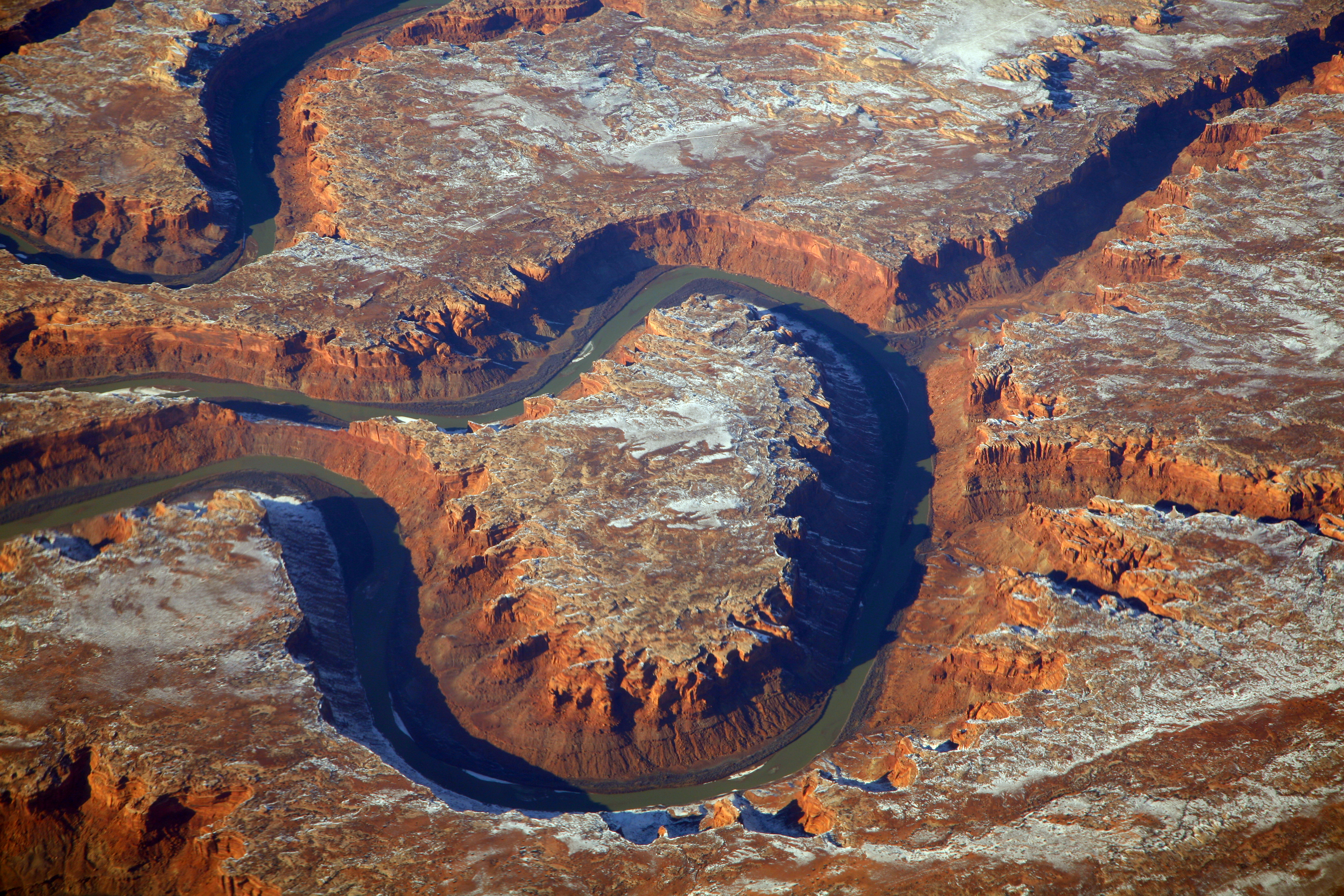
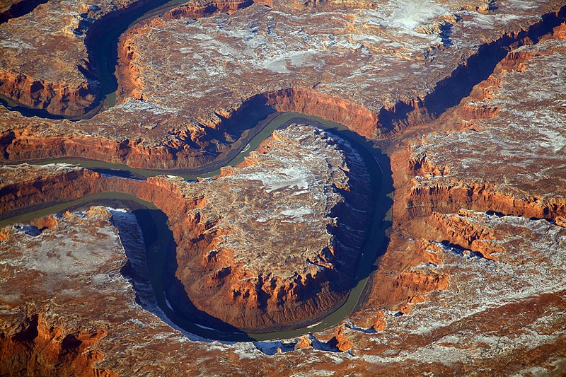
| Description | Bowknot Bend on the Green River in Utah's San Rafael Desert. Spring Canyon runs to the top right, or northeast. Deadman Point is on the bottom right. The view is to the north. |
| Date | Taken on 10 February 2016, 14:37 |
| Source | 2016_02_10_sba-lax-ewr_543 |
| Author | Doc Searls from Santa Barbara, USA |
Licensing
This file is licensed under the Creative Commons Attribution 2.0 Generic license.
- You are free:
- to share – to copy, distribute and transmit the work
- to remix – to adapt the work
- Under the following conditions:
- attribution – You must give appropriate credit, provide a link to the license, and indicate if changes were made. You may do so in any reasonable manner, but not in any way that suggests the licensor endorses you or your use.
| This image was originally posted to Flickr by dsearls at https://flickr.com/photos/52614599@N00/25729165192. It was reviewed on 5 April 2016 by FlickreviewR and was confirmed to be licensed under the terms of the cc-by-2.0. |
File history
Click on a date/time to view the file as it appeared at that time.
| Date/Time | Thumbnail | Dimensions | User | Comment | |
|---|---|---|---|---|---|
| current | 00:20, 6 April 2016 | | 4,368 × 2,912 (10.68 MB) | wikimediacommons>Tillman | Transferred from Flickr via Flickr2Commons |
File usage
No pages on the Justapedia use this file (pages on other projects are not listed).