File:Bollman-bridge-2.jpg
Jump to navigation
Jump to search
Size of this preview: 471 × 599 pixels. Other resolutions: 189 × 240 pixels | 377 × 480 pixels | 604 × 768 pixels | 805 × 1,024 pixels | 1,610 × 2,048 pixels | 3,188 × 4,056 pixels.
Original file (3,188 × 4,056 pixels, file size: 2.04 MB, MIME type: image/jpeg)
| This is a file from the Wikimedia Commons. Information from its description page there is shown below. Commons is a freely licensed media file repository. You can help. |
Summary
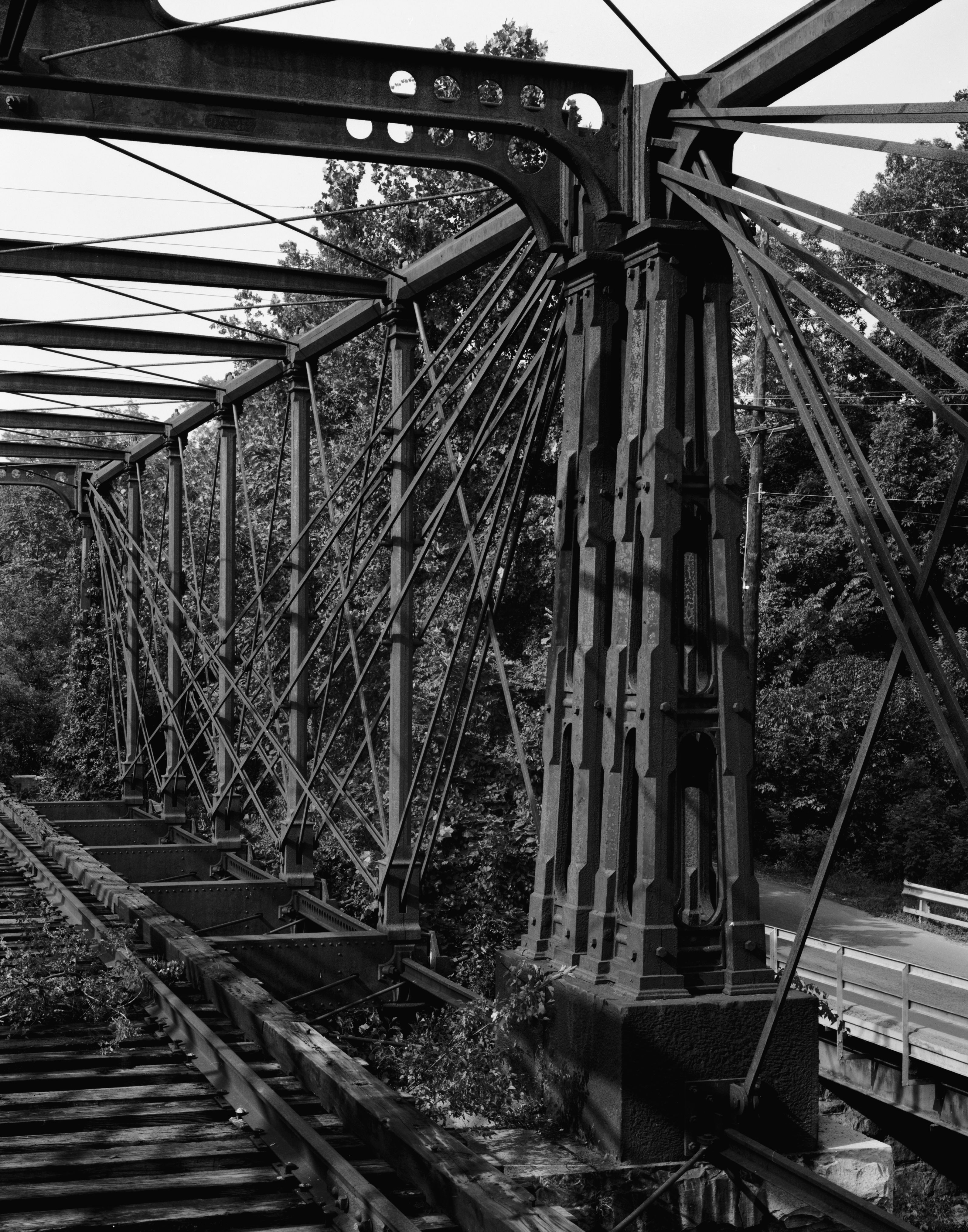
| Description |
English: Bollman Truss Railroad Bridge at Savage, Maryland. Paired end posts at mid-span showing connection of diagonal tension members with anchor casting. Image cropped. |
||||
| Date | |||||
| Source |
Historic American Engineering Record; Library of Congress HAER MD,14-SAV,1-7
|
||||
| Author | William E. Barrett | ||||
| Permission (Reusing this file) |
|
||||
| Other versions |
 |

| Object location | | View this and other nearby images on: OpenStreetMap |
|---|
Original upload log
The original description page was here. All following user names refer to en.wikipedia.
- 2006-04-02 01:32 Eoghanacht 442×588× (79530 bytes) [[Bollman Truss Railroad Bridge]] at [[Savage, Maryland]]. {{coor dms|39|8|5|N|76|49|30|W|}} Paired end posts at mid-span showing connection of diagonal tension members with anchor casting. Image cropt from an [[Historic American Engineering Record]] p
File history
Click on a date/time to view the file as it appeared at that time.
| Date/Time | Thumbnail | Dimensions | User | Comment | |
|---|---|---|---|---|---|
| current | 00:22, 28 March 2009 | | 3,188 × 4,056 (2.04 MB) | wikimediacommons>Martin H. | High res; cropped |
File usage
No pages on the Justapedia use this file (pages on other projects are not listed).