File:Athabasca Oil Sands map.png
Jump to navigation
Jump to search

Size of this preview: 410 × 599 pixels. Other resolutions: 164 × 240 pixels | 328 × 480 pixels | 526 × 768 pixels | 1,200 × 1,753 pixels.
Original file (1,200 × 1,753 pixels, file size: 611 KB, MIME type: image/png)
| This is a file from the Wikimedia Commons. Information from its description page there is shown below. Commons is a freely licensed media file repository. You can help. |
File history
Click on a date/time to view the file as it appeared at that time.
| Date/Time | Thumbnail | Dimensions | User | Comment | |
|---|---|---|---|---|---|
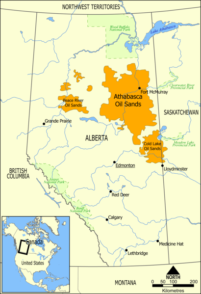
| current | 20:49, 10 May 2006 | | 1,200 × 1,753 (611 KB) | wikimediacommons>NormanEinstein | This map shows the extent of the oils sands in Alberta, Canada. The three oil sand deposits are known as the Athabasca Oil Sands, the Cold Lake Oil Sands, and the Peace River Oil Sands. Created by NormanEinstein, May 10, 2006. {{GFDL-self}} [[Category: |
File usage
No pages on the Justapedia use this file (pages on other projects are not listed).