File:Arthurian Ayrshire map.jpg
Jump to navigation
Jump to search

Size of this preview: 568 × 600 pixels. Other resolutions: 227 × 240 pixels | 454 × 480 pixels | 727 × 768 pixels | 1,050 × 1,109 pixels.
Original file (1,050 × 1,109 pixels, file size: 893 KB, MIME type: image/jpeg)
| This is a file from the Wikimedia Commons. Information from its description page there is shown below. Commons is a freely licensed media file repository. You can help. |
Summary
| Description |
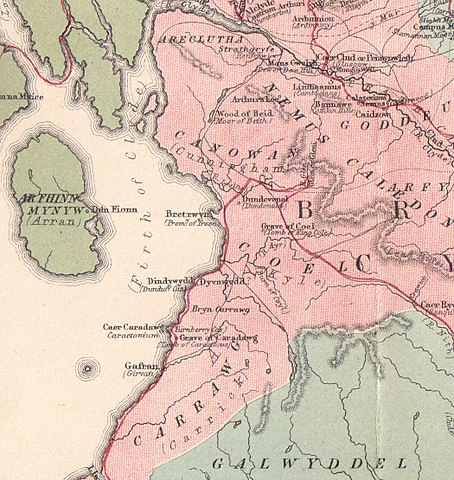
English: A map of Ayrshire indicating King Arthur related locations |
| Date | |
| Source | Arthurian Localities (book) |
| Author | John Glennie |
Licensing
|
This work is in the public domain in its country of origin and other countries and areas where the copyright term is the author's life plus 70 years or fewer. | |
| This file has been identified as being free of known restrictions under copyright law, including all related and neighboring rights. | |
File history
Click on a date/time to view the file as it appeared at that time.
| Date/Time | Thumbnail | Dimensions | User | Comment | |
|---|---|---|---|---|---|
| current | 15:01, 9 December 2010 | | 1,050 × 1,109 (893 KB) | wikimediacommons>Rosser1954 | {{Information |Description={{en|1=A map of Ayrshire indicating King Arthur related locations}} |Source=Arthurian Localities (book) |Author=John Glennie |Date=1869 |Permission= |other_versions= }} Category:King Arthur Category:Maps of Ayrshire [[C |
File usage
No pages on the Justapedia use this file (pages on other projects are not listed).