File:Area codes OH.svg
Jump to navigation
Jump to search

Size of this PNG preview of this SVG file: 576 × 600 pixels. Other resolutions: 231 × 240 pixels | 461 × 480 pixels | 738 × 768 pixels | 984 × 1,024 pixels | 1,967 × 2,048 pixels | 586 × 610 pixels.
Original file (SVG file, nominally 586 × 610 pixels, file size: 44 KB)
| This is a file from the Wikimedia Commons. Information from its description page there is shown below. Commons is a freely licensed media file repository. You can help. |
Summary
| Description |
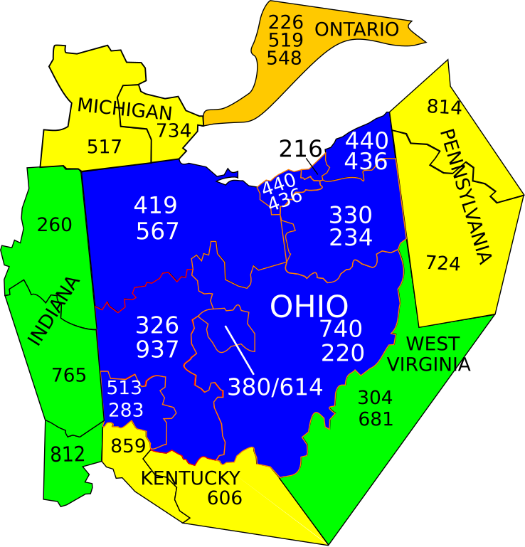
English: Area code map of Ohio in blue, with bordering states/provinces in yellow, green or orange |
| Date | |
| Source | Own work |
| Author | Rfc1394 |
Licensing
I, the copyright holder of this work, hereby publish it under the following license:
This file is licensed under the Creative Commons Attribution-Share Alike 3.0 Unported license.
- You are free:
- to share – to copy, distribute and transmit the work
- to remix – to adapt the work
- Under the following conditions:
- attribution – You must give appropriate credit, provide a link to the license, and indicate if changes were made. You may do so in any reasonable manner, but not in any way that suggests the licensor endorses you or your use.
- share alike – If you remix, transform, or build upon the material, you must distribute your contributions under the same or compatible license as the original.
File history
Click on a date/time to view the file as it appeared at that time.
| Date/Time | Thumbnail | Dimensions | User | Comment | |
|---|---|---|---|---|---|
| current | 04:12, 17 October 2023 | | 586 × 610 (44 KB) | wikimediacommons>Jokerpower71 | Added 436 overlay. |
File usage
No pages on the Justapedia use this file (pages on other projects are not listed).