File:Aitutakicirc.png
Jump to navigation
Jump to search

Size of this preview: 606 × 600 pixels. Other resolutions: 242 × 240 pixels | 485 × 480 pixels | 776 × 768 pixels | 1,034 × 1,024 pixels | 2,069 × 2,048 pixels | 2,859 × 2,830 pixels.
Original file (2,859 × 2,830 pixels, file size: 589 KB, MIME type: image/png)
| This is a file from the Wikimedia Commons. Information from its description page there is shown below. Commons is a freely licensed media file repository. You can help. |
Summary
| Description |
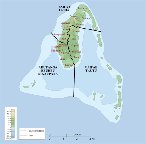
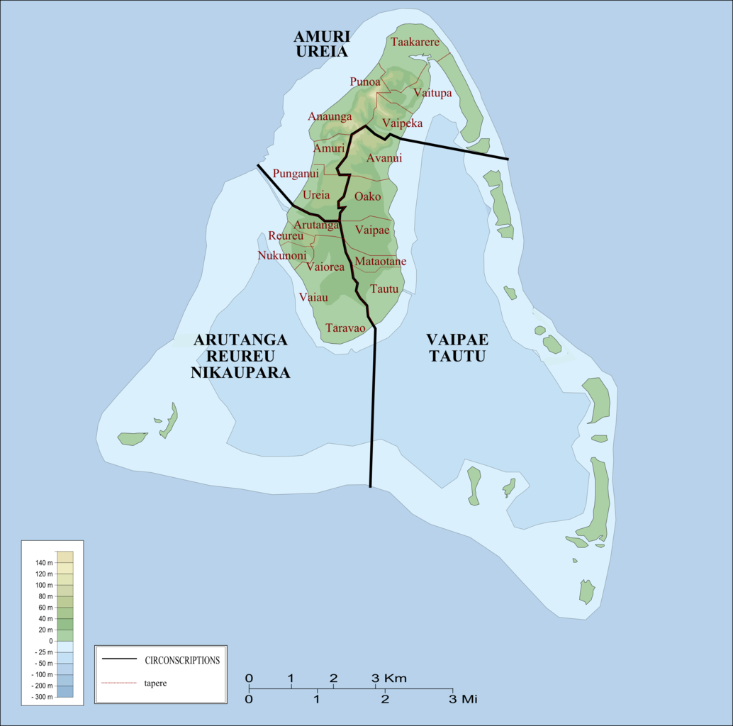
Français : Circonscriptions électorales d'Aitutaki English: Constituencies of Aitutaki |
| Date | |
| Source | Own work |
| Author | Laurent Nevers |
| Permission (Reusing this file) |
GFDL |
Licensing
| I, the copyright holder of this work, release this work into the public domain. This applies worldwide. In some countries this may not be legally possible; if so: I grant anyone the right to use this work for any purpose, without any conditions, unless such conditions are required by law. |
File history
Click on a date/time to view the file as it appeared at that time.
| Date/Time | Thumbnail | Dimensions | User | Comment | |
|---|---|---|---|---|---|
| current | 21:09, 3 January 2008 | | 2,859 × 2,830 (589 KB) | wikimediacommons>Nevers | {{Information |Description=Circonscriptions électorales d'Aitutaki/Constituencies of Aitutaki |Source=own work |Date=Mars 2007 |Author=Laurent Nevers |Permission= |other_versions= }} Category:Aitutaki Category:Maps of the Cook Islands [[Category |
File usage
No pages on the Justapedia use this file (pages on other projects are not listed).