File:1825 Prairie du Chien Line.jpg
Jump to navigation
Jump to search

Size of this preview: 463 × 599 pixels. Other resolutions: 185 × 240 pixels | 371 × 480 pixels | 593 × 768 pixels | 1,275 × 1,650 pixels.
Original file (1,275 × 1,650 pixels, file size: 495 KB, MIME type: image/jpeg)
| This is a file from the Wikimedia Commons. Information from its description page there is shown below. Commons is a freely licensed media file repository. You can help. |
File history
Click on a date/time to view the file as it appeared at that time.
| Date/Time | Thumbnail | Dimensions | User | Comment | |
|---|---|---|---|---|---|
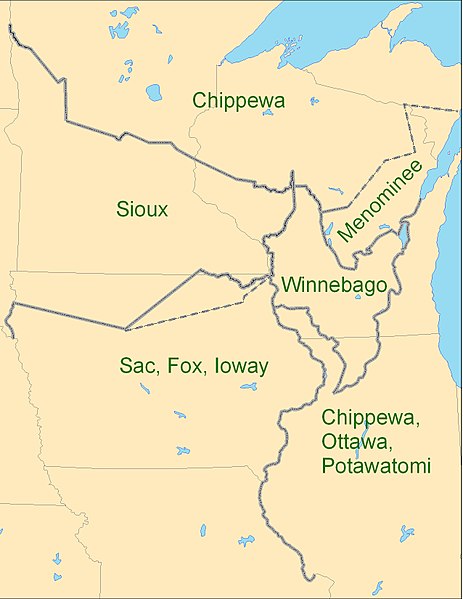
| current | 23:26, 3 September 2009 | | 1,275 × 1,650 (495 KB) | wikimediacommons>CJLippert | {{Information |Description={{en|1=Map showing the boundaries between the Sioux (w:Dakota), Chippewa (w:Ojibwe), Winnebago (w:Ho-chunk), Menominee (w:Menomini), Sauk and Fox (w:Sac and Fox Nation), w:Ioway, and the Chippewa-Ottawa-P |
File usage
No pages on the Justapedia use this file (pages on other projects are not listed).