File:口蹄疫-位置-地図.jpg
Jump to navigation
Jump to search
Size of this preview: 451 × 600 pixels. Other resolutions: 180 × 240 pixels | 361 × 480 pixels | 577 × 768 pixels | 1,120 × 1,490 pixels.
Original file (1,120 × 1,490 pixels, file size: 578 KB, MIME type: image/jpeg)
| This is a file from the Wikimedia Commons. Information from its description page there is shown below. Commons is a freely licensed media file repository. You can help. |
Summary
| Description |
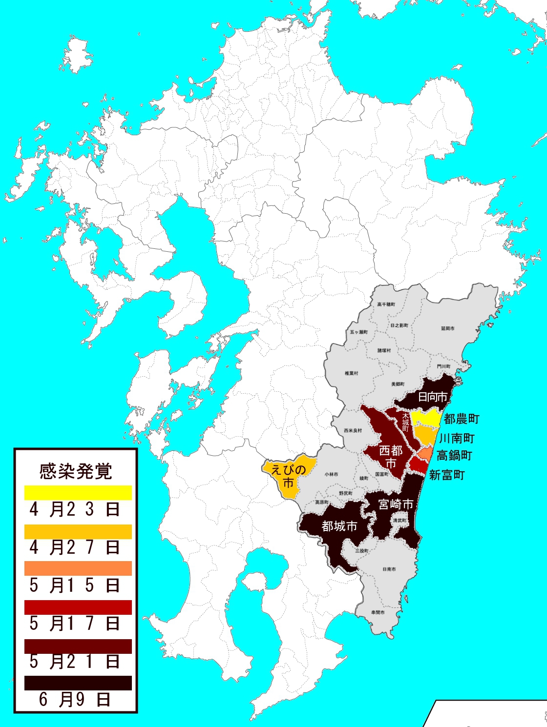
日本語: 日本の宮崎県の口蹄疫の発生地域の地図です。
Italiano: Mappa della comparsa di afta epizootica nella regione di Miyazaki. |
| Date | |
| Source | http://www.freemap.jp/download.php?area=todoufuken&country=miyazaki&file_name=1001_3.png |
| Author |
Licensing
| I, the copyright holder of this work, release this work into the public domain. This applies worldwide. In some countries this may not be legally possible; if so: I grant anyone the right to use this work for any purpose, without any conditions, unless such conditions are required by law. |
File history
Click on a date/time to view the file as it appeared at that time.
| Date/Time | Thumbnail | Dimensions | User | Comment | |
|---|---|---|---|---|---|
| current | 03:17, 25 November 2010 | | 1,120 × 1,490 (578 KB) | wikimediacommons>Dubianman | Category:Maps Category:Japan Category:Miyazaki prefecture Category:Foot-and-mouth disease |
File usage
No pages on the Justapedia use this file (pages on other projects are not listed).