Cuneo International Airport
(Redirected from Cuneo Levaldigi Airport)
Cuneo International Airport Aeroporto Internazionale di Cuneo | |||||||||||
|---|---|---|---|---|---|---|---|---|---|---|---|
 | |||||||||||
| Summary | |||||||||||
| Airport type | Public | ||||||||||
| Operator | Società Gestione Aeroporto Cuneo (GEAC S.p.A.) | ||||||||||
| Serves | Cuneo and Turin | ||||||||||
| Location | Savigliano, Italy | ||||||||||
| Elevation AMSL | 1,267 ft / 386 m | ||||||||||
| Coordinates | 44°32′49″N 007°37′23″E / 44.54694°N 7.62306°E | ||||||||||
| Website | aeroporto.cuneo.it | ||||||||||
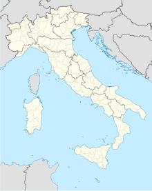
| Map | |||||||||||
| Runways | |||||||||||
| |||||||||||
| Statistics (2019) | |||||||||||
| |||||||||||
Cuneo International Airport (Italian: Aeroporto di Cuneo-Levaldigi) (IATA: CUF, ICAO: LIMZ) also named Cuneo Levaldigi Airport or Turin Cuneo Airport by some low-cost airlines, is an airport serving Cuneo and Turin,[1] Piedmont, Italy. It is the second airport of Piedmont, after Turin Airport.
Facilities
The airport is located at an elevation of 1,267 feet (386 m) above mean sea level. It has one runway designated 03/21 with an asphalt surface measuring 2,104 by 45 metres (6,903 ft × 148 ft).[1]
Airlines and destinations
| Airlines | Destinations |
|---|---|
| Air Arabia Maroc | Casablanca |
| Ryanair | Bari, Cagliari, Palermo, Rome–Fiumicino |
Statistics
Syntax error
Lua error in Module:TNT at line 169: Dataset c:Data:I18n/Template:Airport-Statistics.tab is not valid. Lua error in Module:TNT at line 169: Dataset c:Data:I18n/Template:Airport-Statistics.tab is not valid. CUF Lua error in Module:TNT at line 169: Dataset c:Data:I18n/Template:Airport-Statistics.tab is not valid..
Lua error in Module:TNT at line 169: Dataset c:Data:Original/Template:Graphs.tab is not valid..
References
- ^ a b c Airport information for LIMZ from DAFIF (effective October 2006)
- ^ Airport information for CUF at Great Circle Mapper. Source: DAFIF (effective October 2006).
- ^ "Traffic Data 2019" (PDF).
External links
- Official website
- Current weather for LIMZ at NOAA/NWS
- Accident history for CUF at Aviation Safety Network
