Babil Governorate
Babil Governorate
محافظة بابل Babylon Province | |
|---|---|
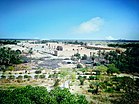
View of the ruins of Babylon from Saddam Hussein's Palace | |
 | |
| Coordinates: 32°37′N 44°33′E / 32.617°N 44.550°ECoordinates: 32°37′N 44°33′E / 32.617°N 44.550°E | |
| Country | |
| Capital | Hillah |
| Area | |
| • Total | 5,119 km2 (1,976 sq mi) |
| Population (2018 Estimate) | |
| • Total | 2,065,042 |
| HDI (2017) | 0.677[1] medium |
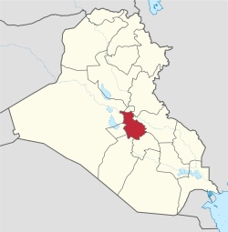
Babil Governorate or Babylon Province[2][3] (Arabic: محافظة بابل Muḥāfaẓa Bābil) is a governorate in central Iraq. It has an area of 5,119 square kilometres (1,976 sq mi), with an estimated population of 2,065,042 people in 2018. The provincial capital is the city of Hillah, which lies opposite the ancient city of Babylon (بابل), on the Euphrates river.
History
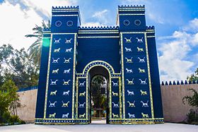
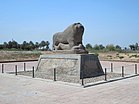
The ancient city of Babylon in present-day Babylon Province was the capital of ancient Babylonia, situated on the Euphrates river south of Baghdad, Iraq.[4]
The city was occupied from the 3rd millennium BC but became important early in the 2nd millennium under the kings of the First Dynasty of Babylon. The sixth king of this dynasty was Hammurabi (1792–1750 BC) who made Babylon the capital of a vast empire and is best remembered for his code of laws.
The city peaked in pre-eminence when Nabopolassar (626–605 BC) and his successor and son Nebuchadnezzar II (605–562 BC) extended the Neo-Babylonian Empire over most of Western Asia.
Bestowing this name on the province is a manifestation of the policy of modern Iraq to link itself to the history of pre-Islamic Mesopotamia.
In 1991 Babil Governorate was the center of a Shia uprising.[4]
Geography
Babylon province is located between 32° to 33.25° North latitude and 44° to 45° East longitude.
Districts
The Babil Governorate is divided into four districts:[4]
- Al-Mahawil District (Al-Mahawil)
- Al-Musayab District (Al-Musayab)
- Hashimiya District (Al Hashimiyah)
- Hilla District (Hillah)
Cities
- Babylon – ancient capital
- Al Hillah (900,000) – provincial capital
- Al Hashimiyah (210,000)
- Al-Qasim (120,000)
- Al Midhatiya (160,000)
- Al Askandariyah (135,000)
- Al latifiyah (150,000)
- Salman Pak (350,000)
- Yousefiah (17,000)
- Musayyib (175,000)
- Jurf Al Nasr (11,000)
- Al Muhaweel (51,000)
Postal codes
- Hillah –51001— الحلة
- University of Babylon –51002—جامعة بابل
- Bab Al Mashhad–51003—باب المشهد
- Eshtar –51004—عشتار
- Al Emam –51005—الامام
- Al Musayab –51006—المسيب
- Al Eskandariya –51007—الاسكندرية
- Al Muhaweel –51008—المحاويل
- Al Mashrooa' –51009—المشروع
- Saddat al Hindiyah –51010—سدة الهندية
- Al Kifl –51011—الكفل
- Al Hashimiyah –51012—الهاشمية
- Al-Qasim –51013—القاسم
- Al Showmali –51014—الشوملي
- Abi Gharaq –51015—ابي غرق
- Al Midhatiya –51016—المدحتية
- Al Nile –51017—النيل
- Al Talee'a –51018—الطليعة
- Jurf Al Sakhar –51019—جرف الصخر
Demographics
| Year | Pop. | ±% p.a. |
|---|---|---|
| 1977 | 592,000 | — |
| 1987 | 1,109,574 | +6.48% |
| 1997 | 1,181,751 | +0.63% |
| 2009 | 1,729,666 | +3.23% |
| 2018 | 2,065,042 | +1.99% |
| Source: Citypopulation[5] | ||
See also
Notes and references
- ^ "Sub-national HDI - Area Database - Global Data Lab". hdi.globaldatalab.org. Retrieved 2018-09-13.
- ^ Parkinson, Jennifer Ann, ed. (1997). "Iraq". Irrigation in the Near East Region in Figures. Rome, Italy: Food and Agriculture Organization of the United Nations (FAO). p. 103. ISBN 978-92-5-103969-4.
- ^ Mohammad, Mohammad Hadi (2012). "Prevalence of Bovine Sarcocystosis in Babylon province (مجلة الكوفة للعلوم الطبية البيطرية)". Kufa Journal For Veterinary Medical Sciences. 3 (2): 78–83.
- ^ a b c "Babil Governorate Profile" (PDF). NGO Coordination Committee for Iraq (NCCI). 15 July 2015. Archived (PDF) from the original on 29 October 2015.
- ^ "Population of Governorates". www.citypopulation.de.


